-lw-scaled.png.png)
Summiting Japfu Peak: How To Climb Nagaland's Second Highest Mountain Without A Guide

We clung tenaciously to man-made handholds, our feet jammed into barely adequate footholds in the naked rock face.
A stiff, icy cold breeze blew away all our cobwebs, tossed our hair and billowed our loose clothing as we scaled these final few fathoms in a bid to reach Japfu peak, the second highest summit in Nagaland.
An occasional glance skyward served to remind us just how close we were to the summit. Soon the precarious ascent would be behind us and we would find ourselves standing atop this great mass of precipitous rock, on what felt, at that moment, like it must have been the roof of the world.
If you happen to be sojourning in Kohima (Nagaland’s largest hill station) for a few nights or attending the globally renowned Hornbill Festival (Dec 1st – Dec 10th), you will find yourself placed in a good position to tackle the iconic Japfu Peak (3,048 m), which is the second highest summit in Nagaland after Mount Saramati (3,826 m).
Is a guide needed to scale Japfu peak?
Misinformation on climbing this peak abounds and many tour operators, travel companies and guides will have you believe that the peak takes two entire days to climb, with a mandatory overnight stay at a base camp near the foot of the mountain at the end of the first day.
This is absolute nonsense and is merely a ploy to drag out the whole ordeal more than is necessary so as to allow guides and operators to earn additional money from clients.
Our experience of climbing Japfu peak was that the full return journey could be comfortably completely as a day trip, with a total time of 7 hours or less required to reach the summit and then return back to the main road.
Before climbing the mountain we undertook some online research and discovered that there was a serious paucity of information on how to actually climb the peak, the location of the trailhead, the distances involved and so forth.
None of the locals or Indian travellers that we spoke to at the Hornbill Festival had a clue how to go about it either.
As a result of our failure to acquire any information about climbing Japfu, we decided to hire a local guide from Viswema village for a day trip to the summit and back. His rate for the day was 1,500 INR and he was unwilling to budge on the price.
Having met the guide and begun making for the peak, we quickly realized that he was an unnecessary expense and all we had really needed to figure out was where the trailhead was.
The route to the summit is actually very straightforward and intuitive with few if any opportunities for getting confused or taking a wrong turn along the way.
That said, we do encourage supporting the local economy and you may still wish to take a guide if you are very inexperienced with hiking and climbing mountains.
Additionally, even if you're confident in your ability to independently navigate your way, a guide can still be beneficial and useful as an informant, providing interesting nuggets, background information and helping you to identify flora and fauna along the way.
The purpose of this online guide is to provide you with all the facts and figures regarding Japfu peak so that you are in a good position to decide whether to hire a local guide or attempt the climb independently.
Location and background info
Japfu peak is located at 25°35’51.0” N 94°04’00.0”E, in the southern Angami region of Kohima district in Nagaland. As the crow files, it’s about 9.4 km southwest of the local ground in Kohima.
The nearest villages to the mountain are Phesama, Kigwema and Zakhama, which lie 10 km, 16 km and 17 km south of the Kohima local ground respectively, on the AH1 road.
The prominent peak towers above the surrounding hills and lies at an elevation of 3,054 m above sea level, placing it more than 600 m higher than the majestic and popular Dzukou valley (2,438m) lying just behind it to the west and southwest.
Somewhere on the slopes of the mountain is the world’s largest rhododendron tree measuring 30.79 metres in height and 2.41 metres in girth, which has been featured in the Guinness Book of World Records, 2007.
We aren’t sure of the tree’s precise whereabouts however and our guide didn’t point out any rhododendron tree during our hike to the peak.
The oak and rhododendron forests that cloak this mountain are also home to the now rare and vulnerable Blyth’s Tragopan (Tragopan blythii), a type of pheasant that is also known as the grey-bellied tragopan.
Three other places in Nagaland where the bird can still be sighted are Pfutsero (the highest village in the state) in Phek district, the Dzukou valley (though the population has suffered heavily here due to wildfires) and the Satoi range in Zunheboto district.
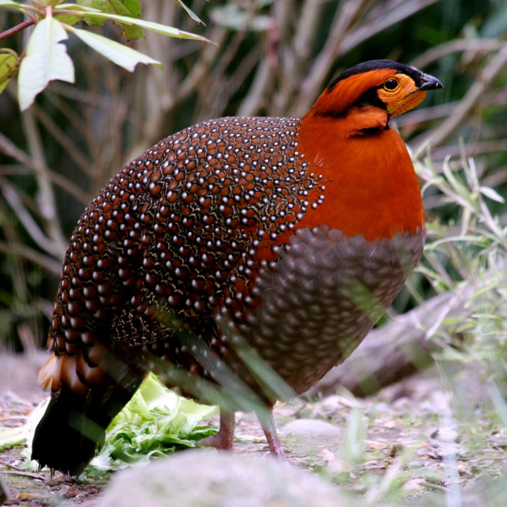
The bird's name commemorates Edward Blyth (1810-1873), English zoologist and curator of the Museum of the Asiatic Society of Bengal.
A mere 2,500 to 10,000 of these magnificently plumaged birds remain in the wild, mostly distributed throughout northeast India, Bhutan, northern Myanmar, south-eastern Tibet and China.
In Nagaland locals report that the birds have become locally extinct in many forests in which they were formerly abundant.
The major cause for the bird’s decline in Nagaland has been large-scale snaring and overhunting with guns and slingshots; many Naga people have an insatiable appetite for meat (including dog meat) and the exotic plumage of the bird is also highly sought after.
A pair of tragopans can fetch between 15,000 – 20,000 INR in the black market, making poaching a lucrative business.
Slash-and-burn agriculture or Jhum cultivation is another contributing factor to the plummeting numbers of the Blyth's Tragopan, as this method of farming entirely decimates or causes fragmentation of the bird’s forest habitat.
Fragmentation of habitat can lead to a loss of genetic variation and problems with inbreeding as the birds do not tend to leave their isolated tracts of forest in search of new individuals to mate with.
There is fortunately some light at the end of the tunnel for the Blyth's tragopan. A community conservation area has been created for the bird in 70 square kilometres of forest near Khonoma village and hunting was banned outright here in the year 2000. The adjoining villages of Mezoma and Jotsama have also banned hunting.
Endangered pheasants aside, another interesting facet of Japfu peak is that, especially in the dry season, the entire mountainside is at risk of being engulfed by forest fires.
These can sadly obliterate many precious and valuable species of flora and fauna that live on the mountain.
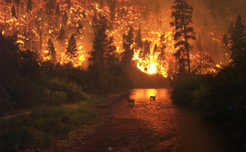
On the evening of January 30, 2014 a blazing inferno broke out here and ravaged the mountain for an entire week. The wildfire is believed to have started at the peak and spread to the densely wooded areas on the southern, eastern and western flanks.
A team of forest personnel, local youth volunteers, soldiers and police were initially dispatched to help control the blaze. Two newly-inducted Russian Mi-17 V5 IAF (Indian air force) helicopters were later deployed to dump thousands of tons of water on the fire over a two day period.
This was the first time in the history of India that helicopters were used to combat a forest fire. You can read more about how the events unfolded here.
Know what's involved
Firstly, be aware that this is more or less a wilderness trek once you pass out of the cultivated valley into the forest, though there is a dilapidated wooden rest house in the middle of the forest en route.
There are no villages, houses or signs of habitation on the route to the summit, as far as we're aware.
As regards water sources, the route initially passes through a valley with a river flowing through it, though the trail does not pass directly alongside the river bank at any point.
After entering the dense forest above the valley there are no obvious water sources that we're aware of, such as streams, lakes, ponds, seepages etc.
The last part of the hike follows a ridge and water is unavailable. The bottom line is carry sufficient water and don't count on finding refills.
The trek begins at an altitude of approximately 1,800 m above sea level if you take a motor vehicle as far as possible to where the trail truly begins.
Since the peak lies at an elevation of 3,048 m, the vertical gain between here and the start point is about 1,248 m, which is nothing to be scoffed at.
A very rough estimate of the distance from the starting point to the summit is about 4.5 km. This was arrived at by using the “measure distance” feature on Google maps with terrain mode enabled.
If you are in decent physical shape and move at a brisk pace, it should take you approximately 3-4 hours to reach the peak from the trailhead. The descent will likely only take two thirds as long as the ascent for most people.
For our Japfu peak attempt at the beginning of December, we set out at 10:30 a.m in the morning and reached the peak at 1:30 p.m, just 3 hours later.
We were moving at a brisk and consistent pace while in motion but we did take plenty of rest stops along the way, as well as stalling several times to take photos and make a few short video clips.
We spent about 25 minutes at the peak and had descended all the way back to the dirt road by 4 p.m, so the actual descent only took us about 2 hours. The total journey time for us was therefore about 5.5 hours.
When to climb Japfu peak
There is no time of year when Japfu peak cannot be climbed, but it is probably best to climb the peak during the drier months of the year and at times when you are more likely to be rewarded with uninhibited panoramic views from the summit and other viewpoints along the way.
We climbed Japfu at the beginning of the December in the winter season (October – February) and the weather on the day of the climb and for the past few weeks had been very agreeable for hiking. It had been very dry without a drop of rain for weeks, skies were a deep blue and almost cloudless, and visibility was excellent.
We felt quite hot at the beginning of the hike because we were bombarded with direct sunshine, but in the shaded forest sections of the hike, we felt much cooler.
The actual air temperatures in the winter season are quite modest, with daytime temperatures at the foot of the mountain not normally exceeding 20°C.
The summit was exposed, windswept and rather chilly. You should factor in a drop of about 6°C for every 1,000 metres of altitude gain.
Do be aware that the sun sets very early in the winter months (around 4:30 p.m in December), so make sure you start early to avoid descending in the dark.
Another time of year that would work well for climbing Japfu is the two-month summer season (March – April) before the monsoon arrives.
This time of year is warmer than the winter season so hiking will probably be a sweatier affair, but chances are that it’ll be dry with good visibility. That said, we have read that visibility is at its best in the winter season.
Inclement weather and poor visibility during the monsoon season (May to September) is likely to put a dampener on your mood when climbing the mountain, and leeches can be another problem associated with this time of year. The three wettest months are June, July and August. See also this climate chart for Kohima.
Though we didn’t climb Japfu during the monsoon and can’t personally report on the abundance of the bloodsucking parasites at this time of the year, our guide informed us that they are legion on the trails during these wetter months.
For how to deal with leeches, see the what to pack section directly below.
What to pack (preparation)
It’s apparently not uncommon for local guides to set out to climb Japfu peak with no supplies of water or food, but this may be because they expect the client to provide for them.
We were obliged to offer our guide food and water because he apparently brought no supplies with him, though oddly enough, he was carrying a daypack, the contents of which remain unknown to us to this day.
We consumed about 500 ml of water per person during our 5.5 hour climb in December, though we likely would have consumed a lot more had we climbed in the warmer summer or monsoon seasons.
We recommend you bring the following essentials:
- Plenty of energy-rich snacks (chocolate, bananas, biscuits, trail mix etc.)
- 1 - 3 litres of water (depending on air temperatures and fitness level)
- A warm pullover or two (it gets chilly if you rest at the peak)
- Headlamp with new batteries (in case you don't make it back before dark)
- Emergency supplies (matches, lighter, sleeping bag, bivvy bag etc.)
Good hiking shoes were not essential in the dry conditions that we climbed in (we wore casual walking shoes with poor grip), but if climbing in wet conditions you would most definitely want to wear a solid pair of hiking shoes.
Trails will be more slippery when wet and there are also a few steep rocky climbing sections on the approach to the summit, which could become quite treacherous if wearing inappropriate footwear.
Our usual preferred defense against leeches is to tuck our pants into our socks, our shirts into our pants and carry a small bag of table salt to sprinkle on any of the blighters that find their way onto our shoes, socks or pants legs. A small squirt bottle filled with brine (saltwater) is also very effective.
We also recommend rubbing generous amounts of salt into your socks and lower pants regions before setting out as a preventive measure to deter the leeches from latching onto you in the first place.
If you have a phobia of leeches or aren't convinced that salt will be sufficient to combat them, it may be necessary to take more extreme measures and wear a pair of anti-leech socks.
A description of the route to the summit
There certainly exists more than one possible route to the summit of Japfu peak.
We were informed that there is a route to the peak from the Dzukou valley, though this trail is reportedly disused and overgrown with thick swathes of bamboo.
Routes from Phousama and Zakhama villages also probably exist, though they are longer and possibly more convoluted than the one we took.
The straightforward and clear-cut route that we took to the summit and that we recommend begins from the outskirts of Kigwema village.
This route is not presently marked in any of the common smartphone navigation apps such as Maps.me, Google Maps etc, but thankfully it is intuitive enough that you don’t need to follow a GPS trail.
Once you identify the starting point you should be fine, but we will also guide you through the route here so that you know exactly what to expect.
To reach the trailhead you will need to take a turn-off onto a dirt road for Japfu Christian College once you’ve headed about 14 km south of Kohima along the main road.
Keep heading uphill past the college, then past a watchtower and soon you will come to a hairpin bend about 2-3 km out this road.
Instead of following the road uphill around this hairpin bend, just keep heading straight to a fence with a wooden style that has been built to allow people to step over it. This is the beginning of the hike to Japfu peak and the closest you can bring a vehicle.
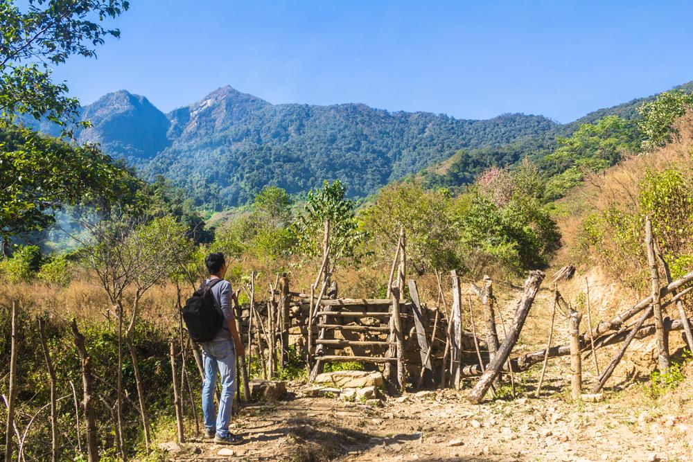
The trail can be roughly divided into three different sections.
Section 1: The cultivated valley
From the style the trail ascends steadily along the northern flank of a gently sloping river valley, which largely consists of presently cultivated and regenerating farmland. The opposite side of the river is densely forested and mostly uncultivated.
The trail first passes through what looks to be a regenerating patch of farmland that has been recolonized by various herbs and shrubs and soon brings you to another style.
After traversing the second style you follow the trail through a small wooded area but soon emerge into the main cultivated part of the valley, which is characterized by a patchwork of small fields and vegetable plots.
We spied potatoes, cabbages, maize, taro, pumpkin and a few other crops growing here. The guide commented that the pumpkins are grown to feed to pigs, though we’re not sure if he meant exclusively.
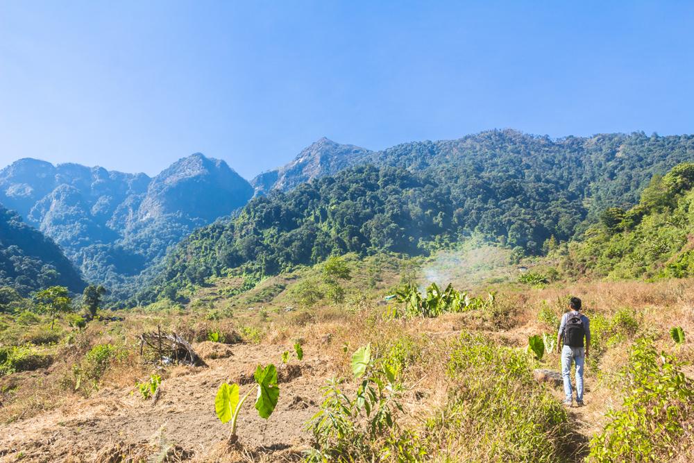
Small huts, some built with stone walls, are scattered among the fields to provide shade and a resting place for hard-working farmers.

As we steadily climbed the trail heading towards the forest in the distance, small seed-eating LBJs (little brown jobs) would fly up from the vegetation next to the trail, disturbed by our presence.
We witnessed just one other person in the entire area that day - a senior woman working alone in a potato field. She was burning a pile of hay and would later spread its ashes on the field as a fertilizer.
The system of farming practiced here is known as Jhum cultivation (slash-and-burn agriculture) and it is very destructive, as it involves completely clearing the existing forest cover and then drying and burning the dead material before the onset of the monsoon season.
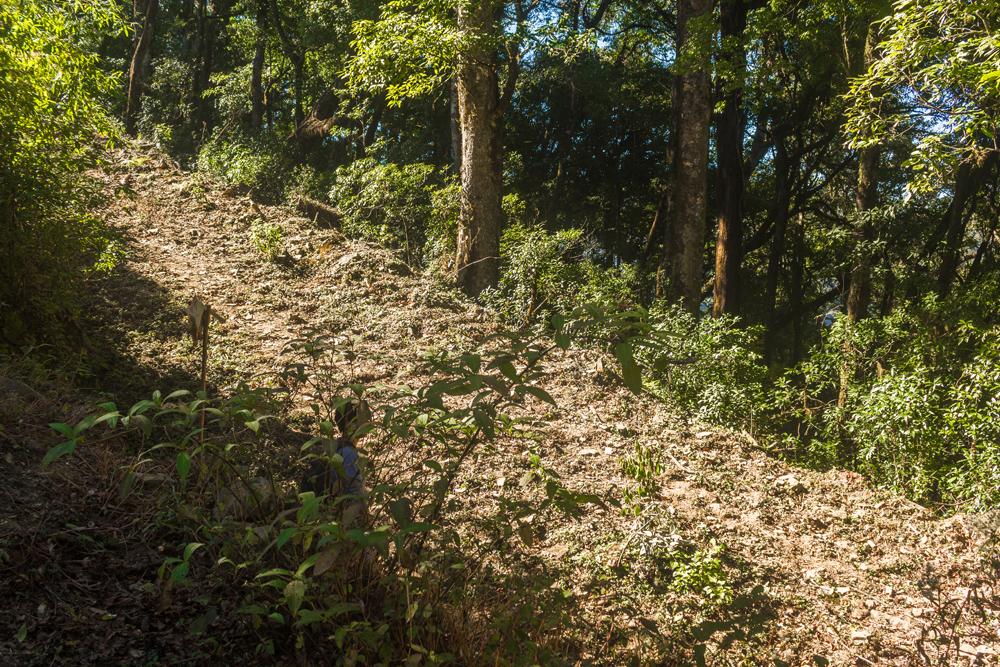
Section 2: Climbing through dense forest
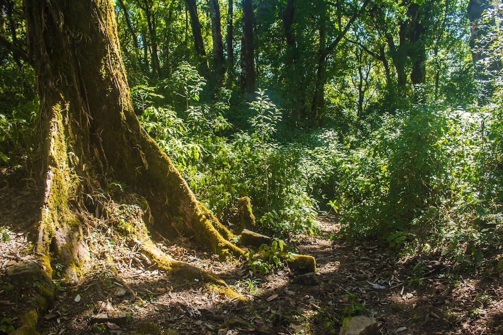
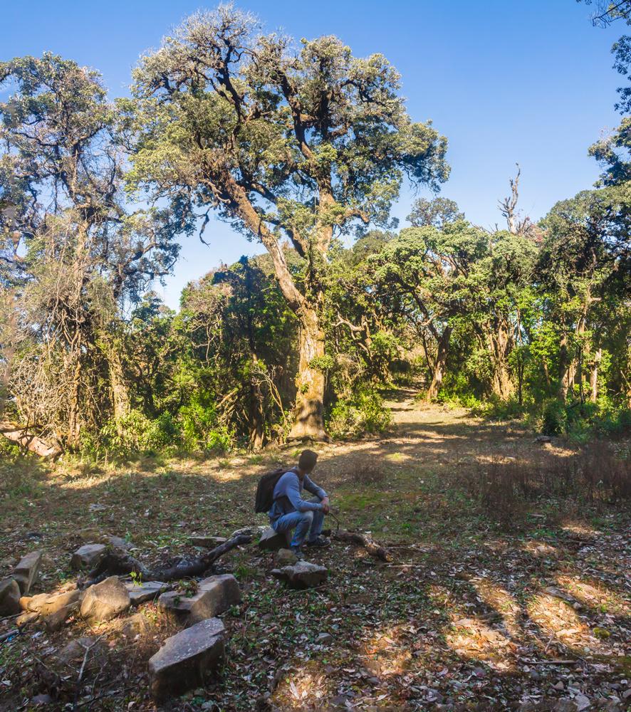
After climbing to the upper reaches of the cultivated part of the valley, the trail transitions into a heavily shaded and somewhat claustrophobic forest. This section of the hike is pretty steep for the most part.
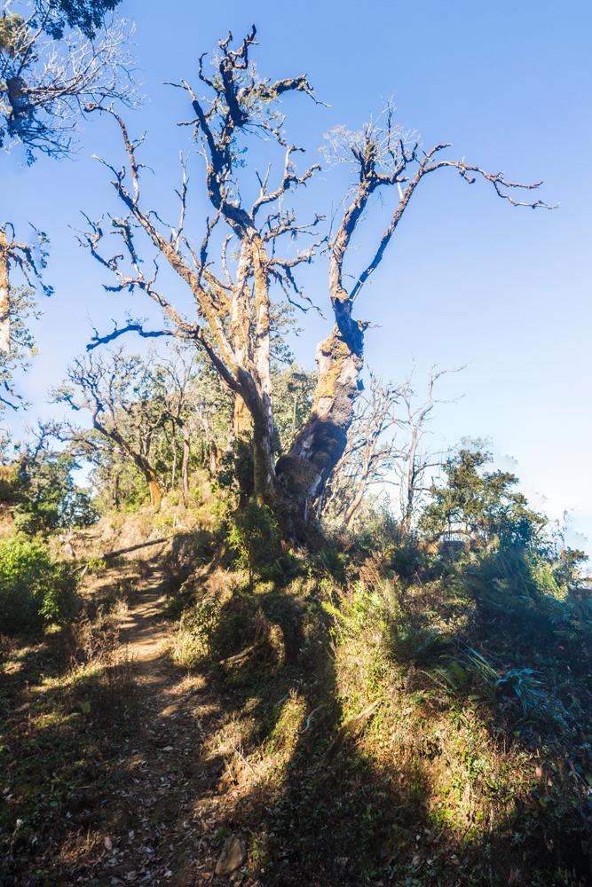
The most remarkable entities in this forest are the enormous aging trees, the boles of which possess impressive girth. However a few of these behemoth tree specimens have toppled over, forcing the trail to pass underneath them.
It was during this stretch of the hike that we encountered a young Naga girl with two boys; the trio were descending through the forest and all were carrying bundles of a particular type of fern.
Our guide explained that these ferns are harvested to be eaten as a vegetable in one of the traditional Naga dishes. He also informed us that the trio had visited Japfu peak earlier that morning.
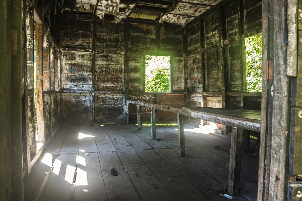
After ascending through the forest for a little while you will reach a dilapidated wooden rest house that has been defaced with graffiti by previous visitors.
The ceiling panels inside are completely torn up and there are a couple of hard wooden beds inside but god forbid that you’d ever have to spend the night here.
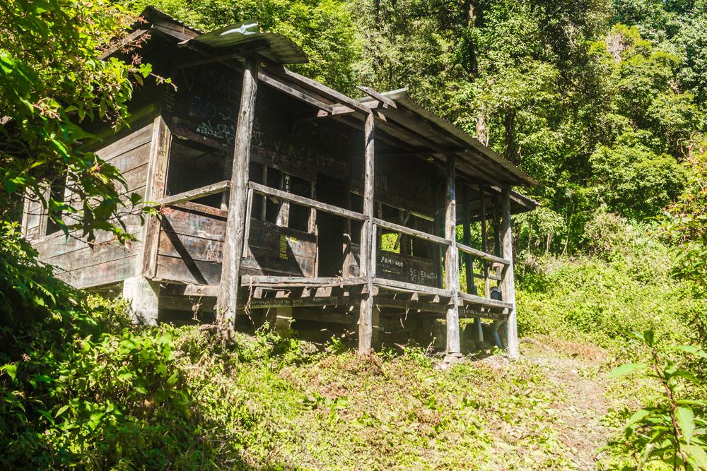
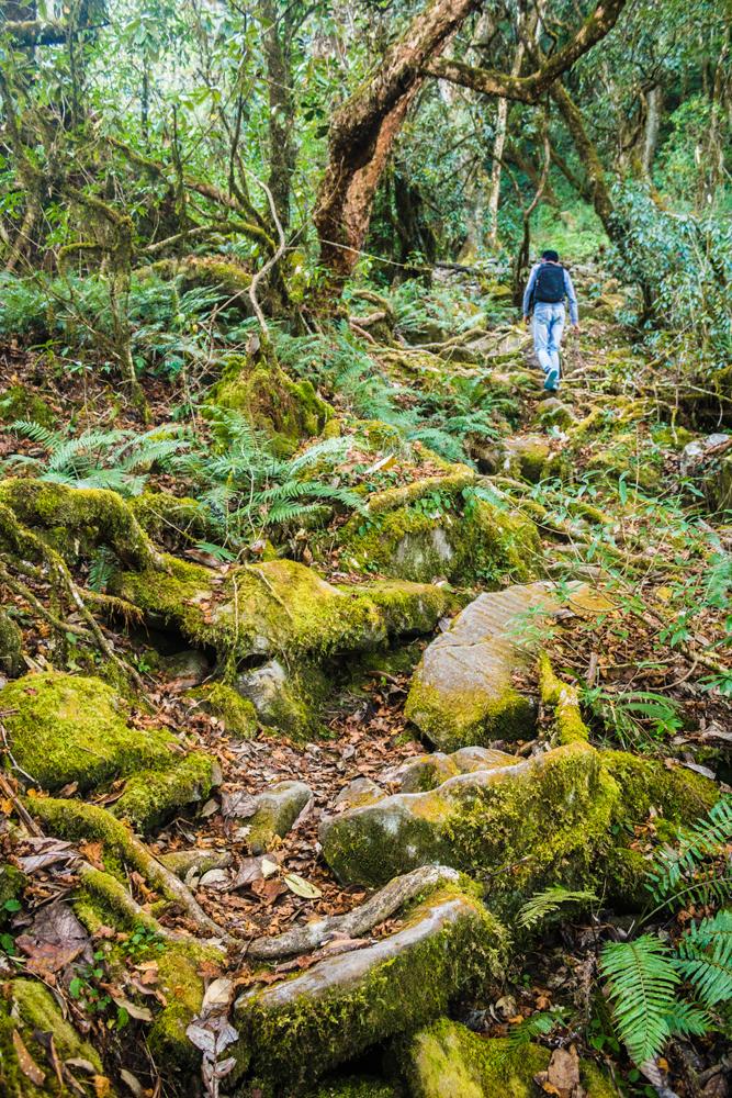
From the rest house the trail continues to climb through the forest until eventually it merges with a stony dirt track that is several feet wide and continues for at least a kilometre. This is the beginning of what we’ll call section 3.
Section 3: Ridge walk to the summit
Once you’ve reached this track you have also reached the ridge that leads directly to the summit. This is roughly the half-way mark. You'll need to follow the track uphill to the left.
The track is mostly ascending, though it does possess a few flattish and even a couple of brief downhill stretches.
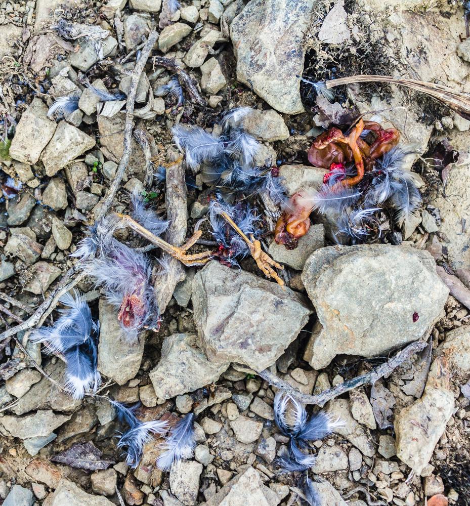
Both sides of the track are densely wooded and our guide took great pleasure in throwing rocks into the thickets in a bid to flush out skulking birds or small diurnal mammals such as squirrels.
It was through observing this behavior that we came to realize how deeply and irrevocably ingrained is the hunting instinct in the psyche of most Naga people, in spite of their having been somewhat pacified and tamed by Christianity over the past century.
We found two conspicuous kill sites on this track, lying only metres apart from one another. The victim was a bird in both cases. At the second crime scene we not only found strewn feathers but also some innards and the two disembodied feet of the avian victim! The guide speculated that the killer may have been a jungle cat (Felis chaus).
At some point along this track you will come to a plateau that commands a magnificent view looking north towards Puliebadze peak, which is itself the best vantage point for observing Kohima.
The next notable landmark after the viewpoint is a large rock face beside the track that has been marred by graffiti.
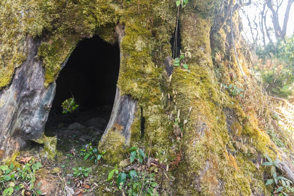
Further on, as you near the end of the track, there is an impressive tree growing right next to the path, the bole of which has been completely hollowed out by the processes of decay and heart rot.
The cavity inside is roomy enough to accommodate several men and would make a great emergency shelter for hikers.
Some distance beyond this senescing tree you’ll come to the end of the track where there is an old campfire site, indicated by a cluster of scorched rocks and a few blackened logs.
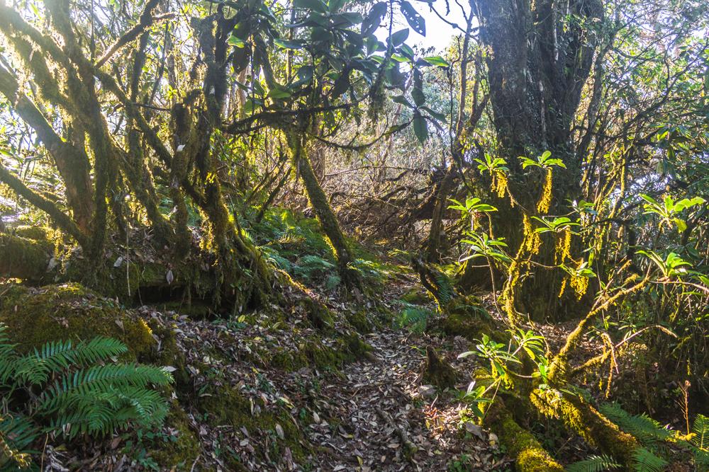
Just beyond the campsite the track peters out and transitions to a narrow walking trail passing through the forest. The path here remains reasonably flat or mildly undulating for some duration.
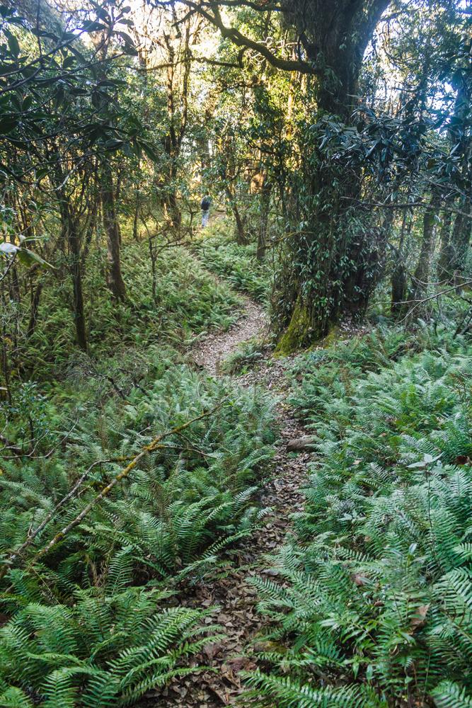
This vegetation belt is often classified as a northern montane wet- temperate forest and occurs above 2,000 metres in Nagaland.
Squirrels are present in respectable numbers and from the one we caught a fleeting glimpse of, we suspect the species to be the hoary-bellied Himalayan squirrel (Callosciurus pygerythrus).
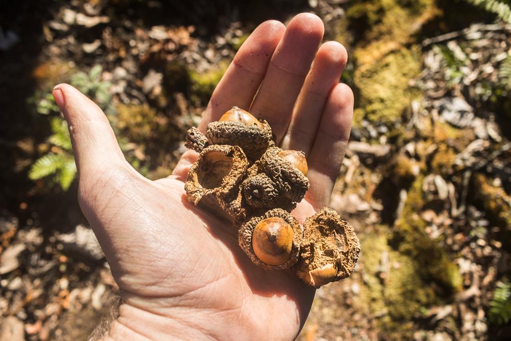
Acorns littered on the ground indicate the presence of oak trees (Quercus sp.). Other tree species we observed in this forest include cherry (Prunus sp.), birch (Betula sp.) Maple (Acer sp.), schima sp. and rhododendron (Rhododendron sp.).
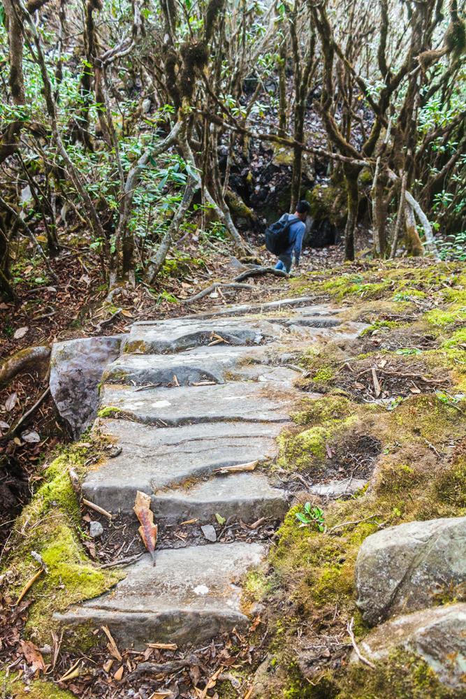
After this flattish stretch the trail begins to ascend quite sharply. It soon passes next to a small cave, which like the previously discussed hollow tree would also make a useful emergency shelter for hikers.
.jpg)
Just beyond the cave you’ll have to clamber up a rather steep slab of exposed rock, hinting at what's in store further ahead.
Following this you’ll come to an even sheerer wall of near vertical rock, though scaling it is relatively straightforward with all the notches that have been cut into it to act as handholds and footholds, as well as the nearby saplings that you can grab onto for extra leverage.
.jpg)
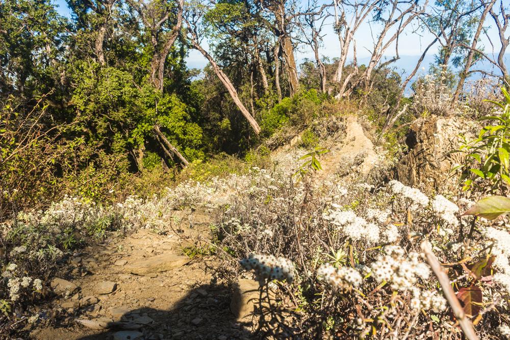
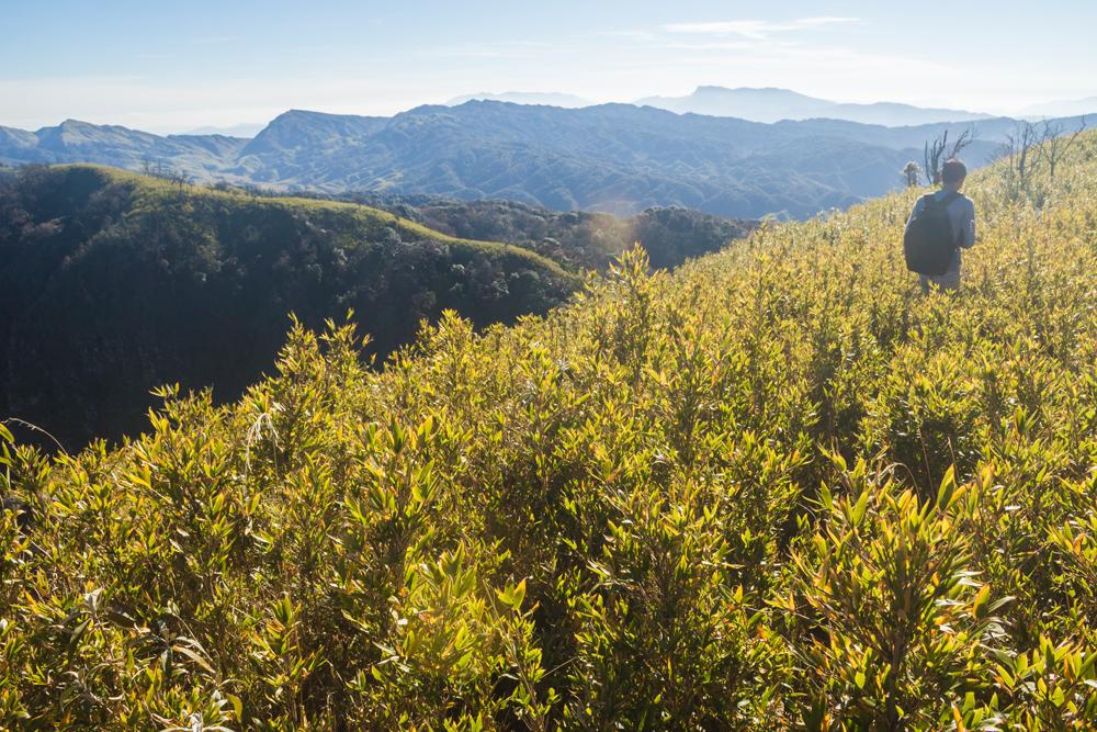
The vegetation gradually becomes thinner, shorter and more stunted as you near the summit. Scrub replaces forest, the soil becomes thinner and the terrain rockier. The wind picks up a little and you begin to feel more exposed.
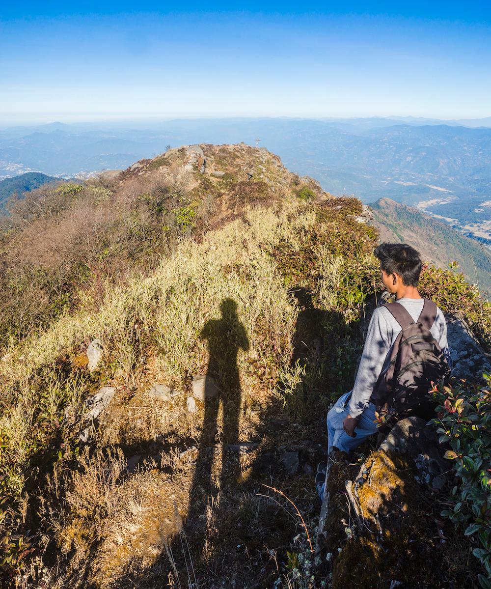
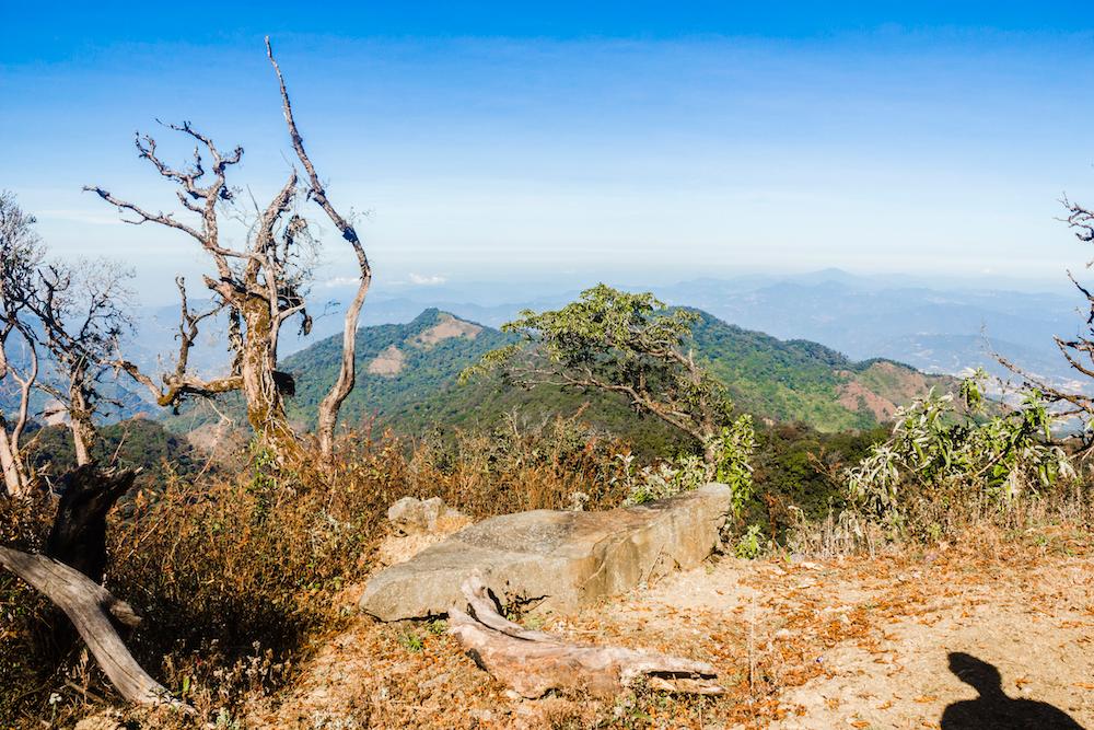
As far as we remember, there are three different rocky outcrops along this final stretch of the ridge, which all serve as vantage points and command splendid views of the hinterlands.
We recall standing at the edge of one of these outcrops as our guide pointed out the distant hazy peak of Mount Saramati, lying far off to the east on the India-Myanmar border in Tuensang district.
.jpg)
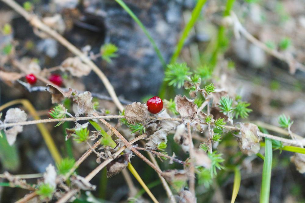
Our guide was very interested in a particular species of plant growing in profusion here on this windswept ridge. The plant trailed along the ground in easily gathered clumps and produced small, attractive red berries.
We were informed that the plant had medicinal powers and once dried could be used to make an infusion or tea for treating kidney ailments.
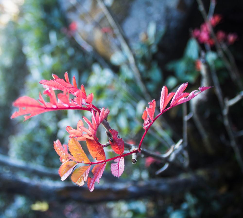
The guide would also pause frequently to admire the seemingly inconsequential but undoubtedly exquisite beauty of certain details along the way, such as the vibrant crimson-hued leaves of a stunted shrub that was struggling to survive up here on this inhospitable ridge.
As is often the case, the last and final push to the summit is the steepest, most treacherous and most exposed part of the climb.
The vegetation here is very sparse and a steeply inclined mass of rock must be surmounted if you wish to attain the summit.
There is fortunately a steel cable that dangles from an anchor point above, thus providing assistance to struggling hikers, though we found it a bit redundant, as there were already sufficient notches, handholds and footholds to climb the rock safely.
We would describe this last and final hurdle as a very easy rock climb or a challenging scramble.
Once you’ve conquered the perilous part, you just have to squeeze your body inside a tight cleft in the rock and then clamber up to the summit, which is marked with a small cross.
The views are superb from here and Kohima is visible, as are the villages of Kigwema, Mema, Pfutsero, Viswema and many others.
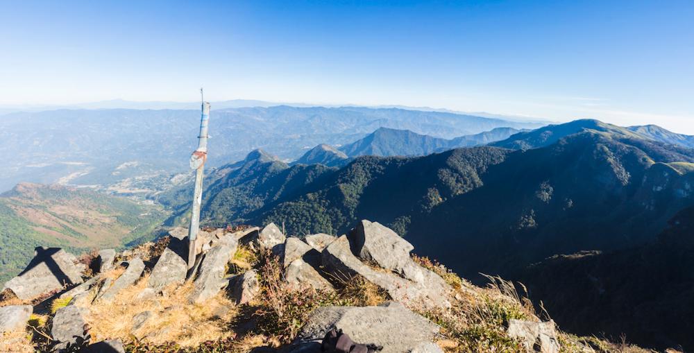
Previous summiteers have unfortunately vandalized many of the rocks up here by engraving their names and other scribbles into them.
.jpg)
Looking back along the ridge we had followed to reach the summit, we could discern the yellow hues of maple trees standing out among an uninterrupted blanket of verdant foliage.
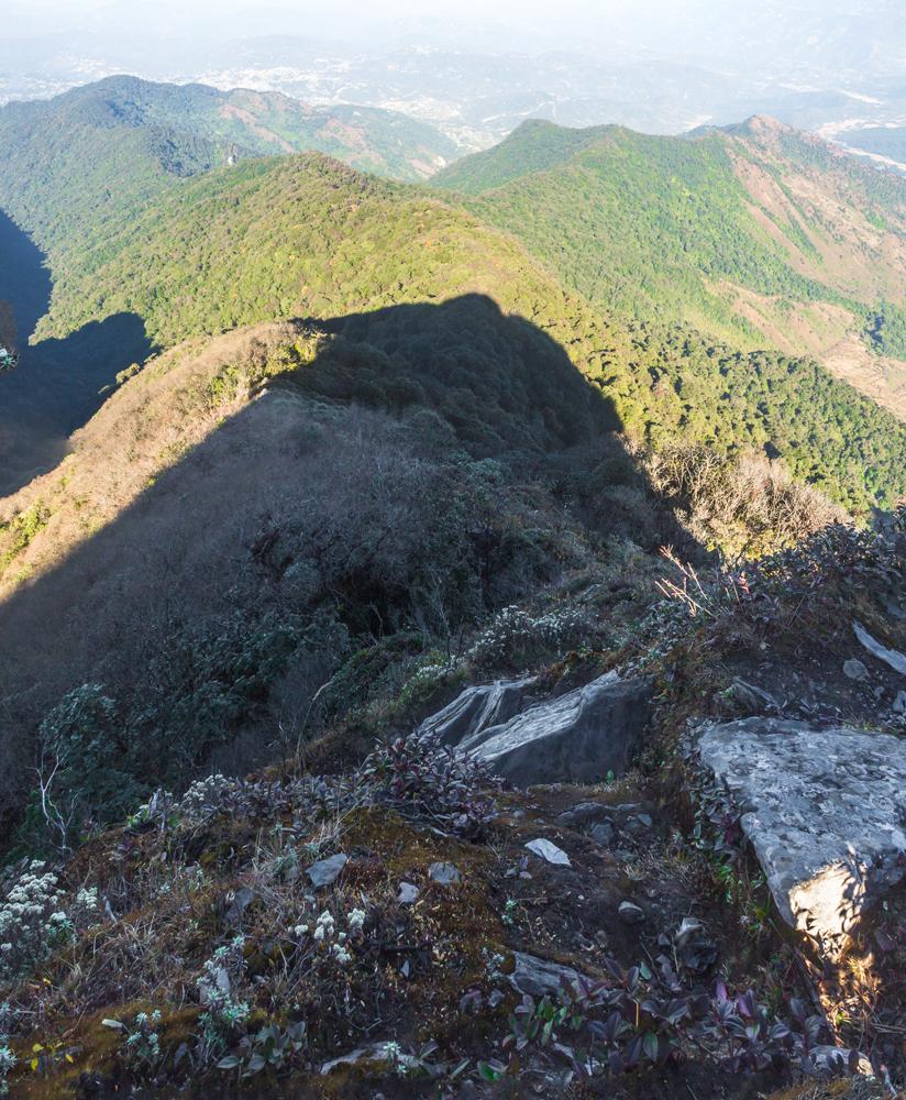
Looking to the south you can see a sheer cliff face, which our guide mentioned had formerly been home to antelopes. He must surely have been referring to the serow (Capricornis sp.), which is a technically a type of goat-antelope and is found in Nagaland.
The guide also mentioned that Naga hunters sometimes come to the Japfu peak area to hunt barking deer (Muntiacus muntjak) and Asiatic black bears (Selenarctos thibetanus).
Shifting your gaze to the west and southwest you can catch a glimpse of the magnificent folds and convoluted contours of the Dzukou valley, which lies some 600 m lower in altitude than the peak.
A trail actually continues along the ridge from the summit, entering thick scrub dominated by a species of dwarf bamboo (Sinarundinaria rolloana), which also clothes the hillocks and valleys of the adjacent Dzukou valley.
Supposedly this path from the summit links up with the valley but as we followed the overgrown trail along the ridge the bamboo steadily became thicker, taller and more challenging to forge a way through.
When the trail had petered out and the bamboo had become impenetrable, we decided to return to the summit to begin the descent back to Kigwema village.
The descent is a little bit tricky on the steep rocky sections but you should be fine if you take your time. It was actually while descending the gentler incline in the densely forested stretch that we almost lost our footing twice due to complacency.
Conclusion
We hope that this guide has somewhat demystified the under-documented Japfu peak and how to go about climbing it as an independent traveller.
As the article has hopefully demonstrated, it is very possible for any reasonably fit individual to scale the mountain from Kigwema village all the way to summit without the assistance of a local guide, and this need not be a multi-day expedition.
If you are very unfit or unpractised when it comes to hiking, hillwalking or climbing mountains, you might be better off climbing Japfu peak with a guide and following the plan that the guide has outlined.
If you enjoyed this article or found it useful, please share it with other travellers. Has the article instilled you with the confidence to tackle Japfu peak? Do leave your comments, questions and feedback in the comment box below and we'll reply as soon as possible.
Pin this article!

JOIN OUR LIST
SUPPORT US
FOLLOW US
ABOUT US

Our names are Eoghan and Jili and we hail from Ireland and India respectively.
We are two ardent shoestring budget adventure travellers and have been travelling throughout Asia continuously for the past few years.
Having accrued such a wealth of stories and knowledge from our extraordinary and transformative journey, our mission is now to share everything we've experienced and all of the lessons we've learned with our readers.
Do make sure to subscribe above in order to receive our free e-mail updates and exclusive travel tips & hints. If you would like to learn more about our story, philosophy and mission, please visit our about page.
Never stop travelling!
FOLLOW US ON FACEBOOK
FOLLOW US ON PINTEREST
