-lw-scaled.png.png)
Wahkhen's Mawrynkhang Trek: Ultimate Guide to Meghalaya's Most Exhilarating Hiking Trail
It is normally the case that the most exquisite treasures of a region are only reserved for those travellers who are prepared to deviate from the major highways, trunk roads and heavily beaten paths of that region.
After all, the popular tourist trails have already been trodden and trampled into the ground by so many people that they have been divested of all the riches they once possessed.
Moreover, many places that are now subject to mass tourism have lost their authenticity, having undergone profound changes to cater to the needs and demands of the constant influx of alien visitors.
To find the proverbial pot of gold at the end of the rainbow, travellers must take the path less travelled and undertake a hero’s journey into the unknown.
This general truth also applies in the mountainous northeast Indian state of Meghalaya ( “the abode of the clouds”), where most visiting tourists plan a road trip that consists of nothing more than a series of pitstops at various points of interest along the main trunk roads of the region.
Most tourists ignore or overlook all of the capillaries and offshoots as they barrel down the highways, not realizing that some of these insignificant looking turnoffs lead to unclaimed riches - incredible secrets awaiting discovery.
A young backpacking couple we recently met on the road expressed to us their disappointment in how their trip through the East Khasi Hills in Meghalaya had panned out.
We weren’t too surprised about their disenchantment with the region when we learned that the couple had adhered to the major highways for the entirety of their trip, travelling from one unpicturesque town to the next without incorporating any offbeat destinations into their itinerary.
Luckily enough though, your trip to Meghalaya doesn't have to end in disappointment like theirs did.
Meghalaya is a state that’s incredibly rich in natural wonders, from sublime waterfalls and some of the world’s most intricate cave systems to ancient living root bridges and breathtaking vistas.
The major obstacle that hinders many travellers from getting to the heart of this region (where most of the real attractions lie in wait) is the dearth of practical information on how to visit the offbeat places.
Some of the articles that appear on the first page of the Google search results deliberately omit crucial practical details so that tourists aren’t informed enough to visit the attractions independently and are thus coerced into booking costly package tours.
In this article we’re going to remedy the dearth of practical information for what is perhaps Meghalaya's greatest secret of all – the exhilarating, adrenaline-pumping Mawrynkhang trek (colloquially known as the bamboo trek) that begins from the remote village of Wahkhen, located in the interior of the East Khasi hills.
In this comprehensive guide to the Mawrynkhang trek, we cover everything you need to know to tackle this trek safely and independently. Reading this guide will allow you to avoid the expense of going through an expensive tour operator.
In the guide we cover the best places to stay in Shillong, Guwahati and Wahkhen village, the exact location of the trailhead, how to get there affordably, what you need to pack, how to do the trek without a guide, entrance fees, a step-by-step photo-illustrated guide to the trek and much more.
Without further ado, let's begin.
Table of contents
- What is the Mawrynkhang trek?
- The legend of U Mawrynkhang
- When to tackle the Mawrynkhang trek
- Where to stay the night before the trek
- Location of the trailhead & how to get there
- Introduction to Wahkhen village
- The bamboo hut in Wahkhen village
- Mawrynkhang trek entrance fees
- What to pack for the trek
- Is a guide necessary for the Mawrynkhang trek?
- A step-by-step guide to the Mawrynkhang trek
To sum it up, the Mawrynkhang trek is a one-of-a-kind hiking trail that begins from the remote Khasi village of Wahkhen and takes intrepid hikers on an exhilarating journey along the face of a gorge, culminating at the apex of a legendary rock that stands prominent amidst a lush river valley.
The Mawrynkheng trek was opened up to the public in 2016 as a means of generating income for Wahkhen village.
The villagers poured their sweat, blood and tears into the project for several months and may have even risked their lives to construct and lay the wooden bridges and ladders on the precipitous rock faces.
The Tourism Trekking Team (TTT) played an important role in the construction of the Mawrynkhang trail and has been trying to gain support from the State Government in widening the road to Wahkhen in order to improve accessibility for tourists.
The village currently receives a steady trickle of adventurous trekkers most days, but this is still very much an offbeat destination in Meghalaya that is not on the radar of most package tourists.
The trail first descends from Wahkhen village to the base of a river valley, crosses the unspoilt Wahrew river via several rickety bamboo bridges and then enters a gorge.
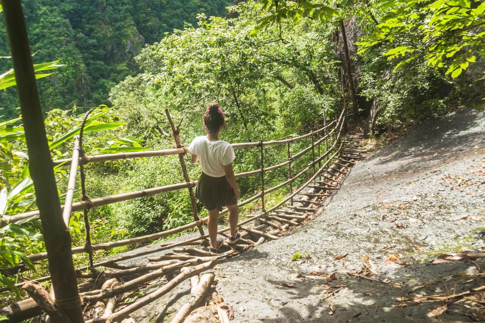
Some stretches of the trail from here on are extremely precipitous and are only passable thanks to a series of man-made, death-defying wooden bridges and inclined ladders that have been installed by the local residents.
Locally sourced bamboo has been used in the construction of many of these bridges and ladders, hence the nickname "bamboo trek".
The trail takes you all the way to the pinnacle of the eponymous U Mawrynkhang, a majestic, legendary rock that soars skywards from the base of a lush river valley cloaked in forest and commands a regal presence over the surrounding wilderness.
Indeed, the word “Mawrynkhang” translates to “king of stones”, a title that relates to an intriguing Khasi folk tale associated with the rock (we’ll get to that in just a second).
The “U” preceding the name of the rock is a mark of reverence used in the Khasi language, something akin to “sir “ in English or “sri” in Hindi.
(See the end of this article for our step-by-step, photo-illustrated guide to the Mawrynkhang trek).
Whether it's a waterfall, a lake, a breathtaking view or simply a hot shower in a trekking lodge, all great treks offer some kind of reward at the end of them - something that makes all the physical exertion and panting and puffing worth it in the end.
In this case, the chance to climb to the summit of a striking natural rock pinnacle amidst a magnificent gorge is reward enough in itself, but knowing the Khasi folk tale behind the formation of the rock will make the trek even more exciting, meaningful and rewarding.
In Khasi legends, inanimate objects (such as rocks) in the natural environment are often personified and embodied in folk tales as a way of explaining their existence and certain observable physical features that they possess.
According to the Khasi legend, there was once a great battle of rocks and one giant rock emerged victorious after vanquishing all the others. This stone became known as U Mawrynkhang, the king of stones.
The king was soon to fall head over heels in love with a beautiful damsel rock called “Kthiang” from another kingdom, but as you might have guessed, he was not the only one with his eyes on this attractive lady rock.
The antagonist in this story, Mawpator, was also smitten with Kthiang and inevitably the two male rocks entered into a bloody battle, both risking their lives for the sake of the prize.
During the battle, Mawpator broke off Mawrynkhang’s left arm. Enraged by this and unwilling to accept defeat, Mawrynkhang summoned all his courage and strength, and eventually succeeded in decapitating Mawpator.
To this day it is said that when standing atop Mawrynkhang one can witness the rock of his maiden Kthiang behind him, while another rock down in the valley below is said to be the severed head of Mawpator.
The scar from where Mawrynkhang’s arm was broken off is still visible on the face of the rock today.
Wahkhen experiences the highest levels of precipitation in the warmer summer months, with June and July being the wettest months.
The winter months are much drier and cooler by comparison, with the driest months being December and January.
The spring and autumn months lie between the extremes of summer and winter, experiencing more moderate temperatures and levels of precipitation.
From a safety perspective, it would be best to tackle the Mawrynkhang trek during the drier winter months, when the trails are less likely to be wet and slippery. Trekking in the cooler temperatures at this time of year will also be more pleasant.
However, there are also some advantages to trekking in the warmer, wetter months.
The vegetation is at its most verdant and lush during this period and the rivers have become roaring torrents that make for an exciting adventure. You are also more likely to be able to find a place to refill your water bottle on the trail during the wetter months.
I would advise you to tackle this trek whenever you get a chance, regardless of the time of year, as it offers different challenges in different seasons and can be enjoyed in all but the very worst weather conditions.
There are three or four viable options for where to stay the night before you tackle the Mawrynkhang trek.
Bear in mind that the closer you stay to the trailhead, the less early you will have to wake up on the morning of the trek and the less rushed the trip will be for you in general.
It is generally advisable to begin the trek no later than 1 p.m in the afternoon, so take that into consideration when deciding where you want to spend the night prior.
Option #1 – Stay in Shillong
Many people do this trek as a day trip from Shillong, setting out early in the morning and then returning to the city later on the same day after completing the trek.
If this is your plan, you’ll need to find a place to stay in Shillong, which can be a surprisingly difficult feat to accomplish if you're on a budget.
It can sometimes be almost impossible to find a double or twin room in Shillong even for Rs. 1,000/- , which is still a lot more than what many budget travellers are happy to pay.
And when you do find a property in Shillong with rooms that cost less than Rs. 1000/- , it will normally have restrictions like “only Indians allowed” or will be infested with bed bugs, or used as a brothel or located on the distant outskirts of the city.
One property in Shillong that does accept foreigners and has double rooms that are often priced below Rs. 850/- is an OYO property called Dew Drops Guest House (OYO 23002).
It’s not in an ideal location (2.1 km from the Police Bazaar roundabout) but the rooms are at least reasonably clean and free of bed bugs, which can’t be said for some of the budget rooms in the city centre. We stayed here on the first night of our trip from Guwahati.
Solo travellers and backpackers would do well to pay for a Rs. 400/- dorm bed in the foreigner-friendly Isabella Hostel, which is located in the Laitumkrah area of Shillong, about 2.9 km from the Police Bazaar roundabout.
Generally, you will find the cheapest rooms in Shillong by searching online booking platforms like OYO, Agoda, Booking.com and Goibibo.
You can use the box below to search for rooms in Shillong on your chosen travel dates:
Option #2 – Stay in Guwahati
If you’re coming from Guwahati, it is also possible to complete the trek the same day, but you will have to leave Guwahati very early in the morning (I would advise no later than 7 a.m). You should be able to make it back to Guwahati late in the evening on the same day.
If you require affordable accommodation in Guwahati, you can stay at our very own, newly opened budget guesthouse, a retreat amidst nature on the quieter city outskirts.
"A serene family home cradled by coconut palms, areca palms, fruit-bearing trees and lush greenery with sweeping rooftop views of the Guwahati hinterland stretching all the way to the enigmatic foothills of Meghalaya. A soft breeze billows the window curtains while thunderstorms brew in the far-off hills. Birds sing sweet melodies in the trees during the day while fireflies enchant it at night. The house has a rustic charm yet is equipped with all the conveniences you need to enjoy your stay."
The property is called Blissful Eyrie and rooms are bookable on Airbnb, Booking.com, Goibibo, Makemytrip, HomeAway and several other online platforms. Check it out!
You can also use the box below to search for other hotels in Guwahati:
Option #3 – Stay in Pynursla town
If you want to stay a bit closer to the trailhead the night before but not have to forego all mod cons by staying in Wahkhen village, the town of Pynursla is only about 31 km away (closer than Shillong at least) and has a few homestays, shops and restaurants.
If you’re planning to spend the night here in Pynursla I’d recommend Moi Homestay. It's the cheapest and best homestay in town and is only a short walk from the town centre. During a previous Meghalaya trip we managed to snag a double room with external bathroom here for Rs. 700/- .
If that option doesn’t work out for you, there’s always Er-Batemon Homestay to fall back on, although it’s on the town outskirts at the top of a small hill, so the location is less ideal.
You can use the box below to search for hotels in Pynursla:
Option #4 – Stay in Wahkhen Village
There are no official guesthouses or homestays in Wahkhen village as of late 2019, but you may be able to find accommodation in the village with the assistance of one of the locals.
If worst comes to worst, you might even be able to spend the night in the village church or in one of the school buildings.
In our case, we travelled from Guwahati to Shillong by shared Sumo late in the afternoon on Day 1, so we were forced to stay in Shillong that night.
On the afternoon of Day 2, we departed from Shillong for Wahkhen, with the intention of staying in the village that night and tackling the trek the following morning.
We didn't know for certain if there would be a place to stay, but we had a hunch that we would find something, so we took our chances.
When we first arrived in Wahkhen, a local boy called Shutit that we met in the village tea stall (more on that below) was kind enough to fix us up (thanks to his father's connections) with a place to stay in an abandoned section of a local family’s home.
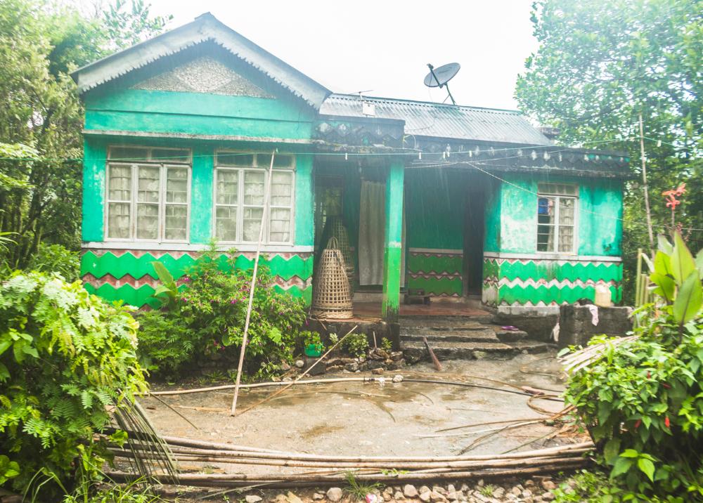
Initially, the plan was for us to be accommodated on the ground floor of a relatively affluent-looking, two-storey house in the village that belonged to a friend of Shutit's father.
He guided us to this house when the light was fading in the evening but upon reaching the property it became evident that the owner was absent and would not be returning any time soon, so Shutit was forced to make alternative arrangements for us to stay with a different family.
The facilities that were provided by this family were very bare-bones mind you, and the standards were probably below what most people would be able to tolerate for even a single night.
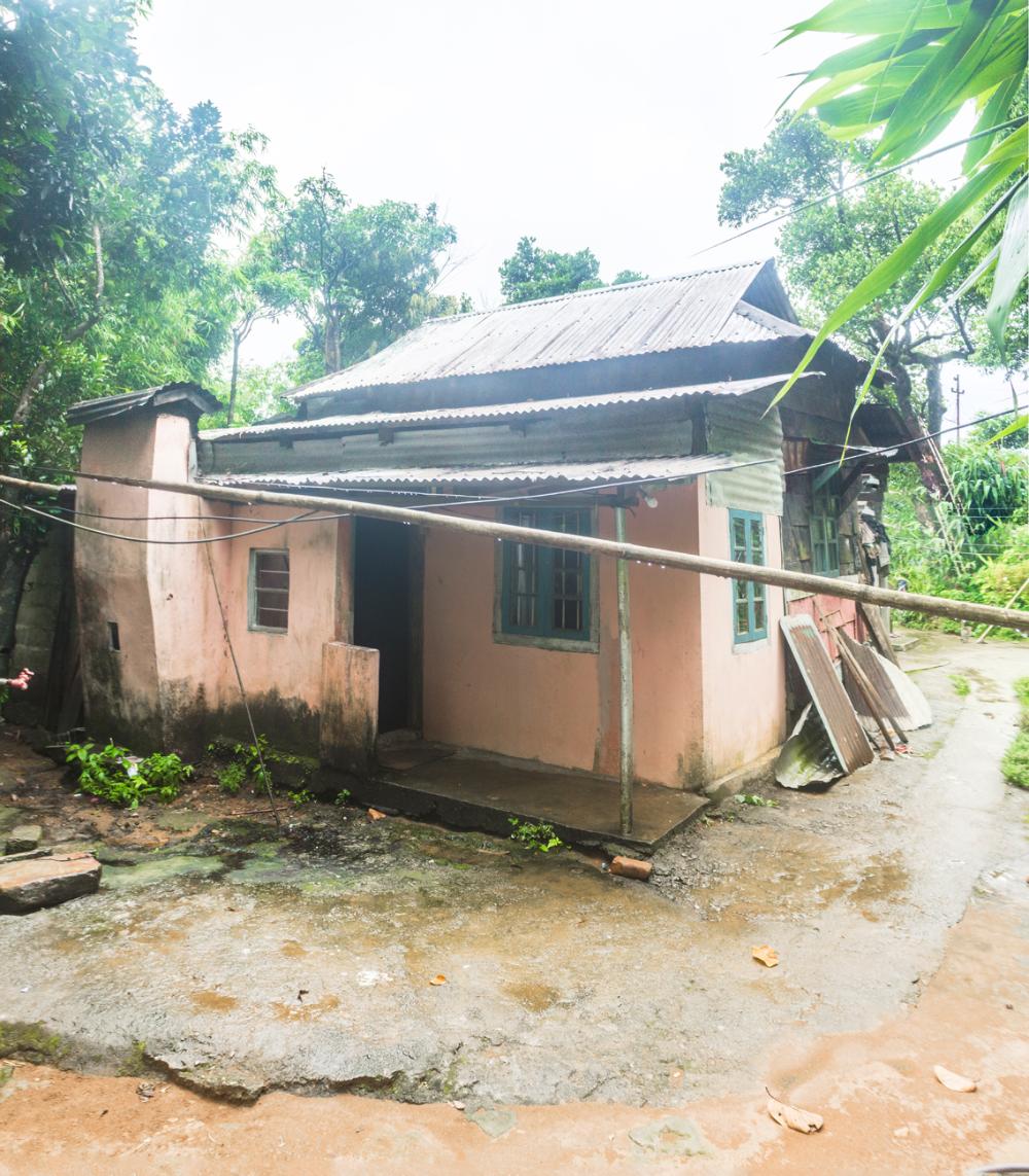
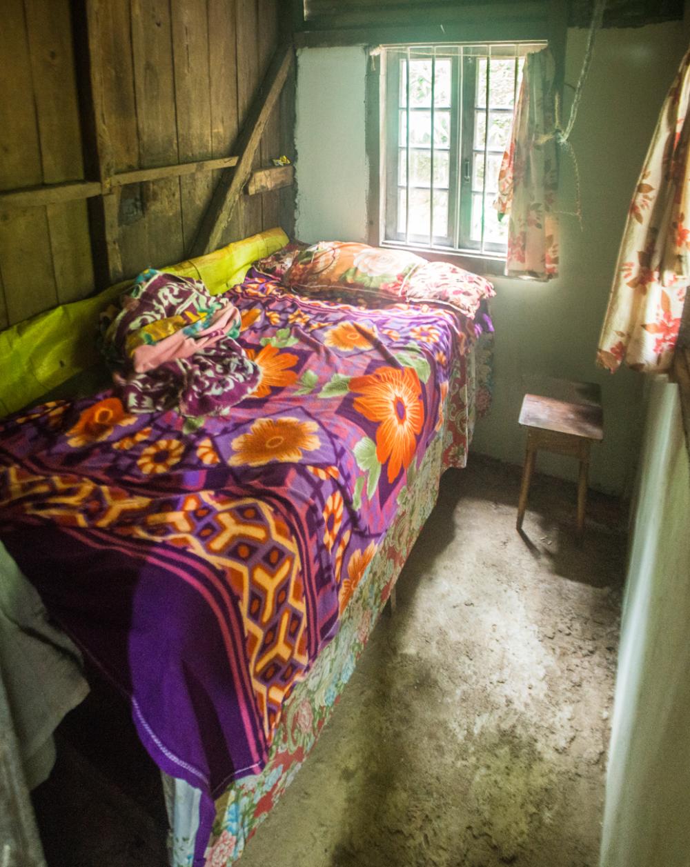
The room we were offered was more easily described by what amenities it lacked rather than by what it possessed.
For starters, it was barely large enough to accommodate the mattress-less cot that it housed.
The walls were constructed from wooden boards that had large gaps between them and were now partially rotted, insect-damaged and cobweb-ridden.
The windows had a few broken panes and the room had no door, no lightbulb, no power outlets, no fan, no hangers, no mirror, no mosquito net and almost no furniture. Definitely no TV, air-conditioning or bedside runner.
The single available power outlet outside the room wasn’t charging our phones. Wahkhen village apparently has a very unreliable electricity supply.
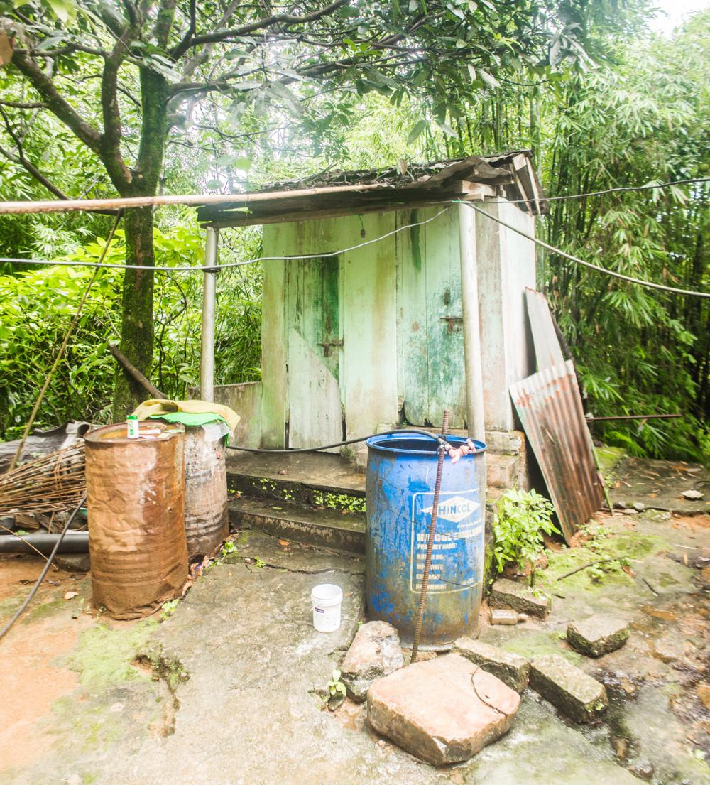
The “bathroom” just outside the bedroom was a miniscule (about one square metre), featureless, all-concrete room with a small hole at the base of one of the walls to allow water to drain out.
The two toilets were of the squat variety and were located in a small outhouse adjacent to our room. We at least had a tap with running water and were also able to use the rainwater that had collected in a large plastic drum in front of the outhouse.
The family did at least provide us with two small stools to sit on, two pillows, a few blankets and some Mortem mosquito coils to burn, as there were a few errant mosquitoes flying about the house.
Despite the dilapidated condition of the room and the extremely basic facilities, the man of the house tried to charge us Rs. 1,000/- for a one-night stay here, as he knew that we had virtually no other option.
After some negotiation we together agreed on a price of Rs. 700/- and then settled in to a long, cramped, sleepless night on the narrow, uncomfortable wooden bed, trying not to think too much about the dead baby scorpion that we had found lying on the floor outside our room.
A thunderstorm rolled in around 8 p.m with accompanying heavy rain, which continued unabated until the late morning, making it impossible to even go to the toilet during the night without getting a thorough soaking!
Luckily, the tin roof over our heads did a commendable job of shedding the rain; a leaky roof that night would have been our worst nightmare.
The Mawrynkhang trek begins from the remote Khasi village of Wahkhen of Pynursla Tehsil in the East Khasi Hills district of Meghalaya. The village is approximately 49 km from the state capital of Shillong.
The exact location of the trailhead in Wahkhen village is at the point marked "MAWRYNKHANG ENTRANCE" on Google Maps, about 750 metres before the road terminates at the end of the village.
A motorable road (Wahkhen Rd) goes all the way to Wahkhen village from the junction at Pomlum, which is located 34 km south of Shillong on the Laitlyngkot – Pynursla – Dawki highway (AH2).
A large yellow sign at the junction that reads:
INDIA TOURISM SHILLONG
WELCOME
POMLUM
WAHKHEN VILLAGE 15KM
(MAWRYNKHANG TREKKING DESTINATION)
…should clear up any confusion that you’re at the correct turnoff.
From the Pomlum junction, it’s another 15 km to Wahkhen village along a single-lane, winding road that is still partially under construction.
While driving along this road we had to back up a few times to allow large trucks (carrying materials for road construction) going in the opposite direction to get past us.
The road is bumpy and potholed in parts but the overall condition is decent enough. It descends gradually from an elevation of about 1650 m at Pomlum to an elevation of about 900 metres at Wahkhen.
To get to Wahkhen village from Shillong here are your four best options:
Drive your own vehicle:
If you have your own vehicle, you can easily just drive the 49 km to Wahkhen village from Shillong. The journey should take you approximately 2 hours. There is a car park right next to the Mawrynkhang trailhead in the village.
Reserve a taxi to Wahkhen:
Taxi drivers in Shillong usually charge Rs. 2000 to charter their taxi to Wahkhen village, wait for you to finish the trek and then drop you back to Shillong afterwards.
A taxi fits 4-5 passengers, so transportation for the trip will only cost Rs. 400 -500 per person if you have a group of 4-5.
If you only want to be dropped off in Wahkhen because you plan to stay in the village overnight or because you aren’t returning to Shillong after the trek, taxi drivers normally charge Rs.1500 for a one-way drop to the village.
The Police Bazaar roundabout in Shillong is a good place to approach taxi drivers with your proposal, as there are always plenty of them stationed here.
Take a shared taxi to Pomlum junction and hitch a ride from there (cheap option) :
The “Indica Pynursla No.1” shared taxi leaves from the Bara Bazaar taxi stand in Shillong.
(To get to Bara Bazaar from Police Bazaar you can either walk or take a shared taxi going that way for Rs.10. The taxi stand is just a short walk from the Bara Bazaar roundabout (ask someone to direct you there), where you’ll most likely be dropped if you’re coming here by shared taxi.)
This shared taxi will drop you off at the Pomlum junction on its way to Pynursla but you will still have to pay the full fare of Rs. 90.
In our case this taxi was a large, blue-and-orange sedan type vehicle as opposed to one of the smaller yellow-and-black Maruti Suzuki hatchbacks that you see everywhere in Shillong and in Meghalaya in general.
As regards the timings of this shared taxi, it seems to just leave whenever it fills up with passengers. I would assume this taxi makes several trips each day starting from fairly early in the morning. Our taxi left the stand around 1:45 p.m.
Once you get out of the taxi at Pomlum junction, you can try to catch a ride to Wahkhen from here.
Taxis that other tourists have reserved to go to Wahkhen probably won’t stop for you, but you may be able to hitch a ride with a local returning to the village or with an outsider paying a visit.
Try to get to the junction as early in the morning as possible to maximize your chances of getting a ride.
We managed to get a lift in a small car with three local men who had been attending a meeting in Pomlum and were on their way back to the village.
When we got out of the car in Wahkhen the man looked like he was expecting some compensation so we asked him how much he wanted for the favour and he said “40 rupees each”.
That seemed reasonable enough for an almost hour-long 15 km ride on a bumpy road, so we paid our dues, thanked the driver and bid farewell.
Take a shared taxi to Rngain and hike into the village from there (adventurous and cheap option):
This is similar to the previous option, but in this case you would continue past Pomlum junction for a few kilometres in the shared taxi coming from Shillong, and you would get down at Rngain (which I’ve forgotten how to pronounce). From Rngain there is supposedly a walkable trail leading to Wahken village.
I can’t offer any further counsel here, as I have not taken this route myself, so you would be best to consult with a local if you’re planning to trek into the village from Rngain.
Wahkhen village falls under the Pynursla civil sub-division and lies at an elevation of approximately 900 metres above sea level.
The village name derives from the words “Wah” (river) and “Khen” (to flow), so it translates to something like “river that flows”.
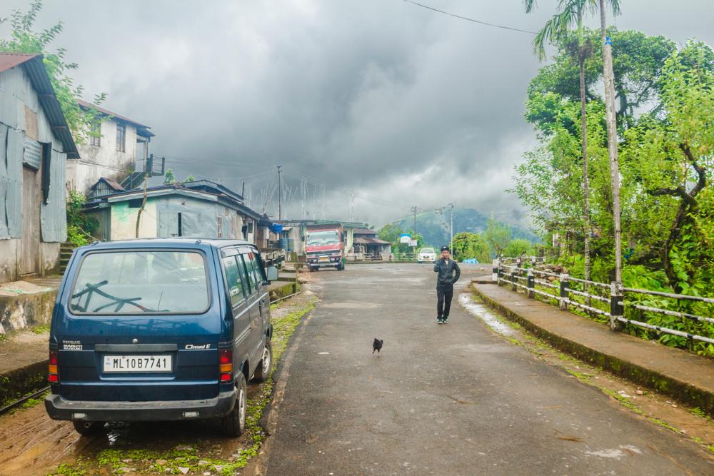
When you reach Wahkhen you will observe that it’s a small Khasi village in the lap of nature with homes and other buildings scattered on either side of the stretch of road that passes through it.
The village has a church, a lower primary school (up to class 5) that was established back in 1957, a music school that is devoted to keeping traditional Khasi music alive (classes are held on Sunday mornings from 11 a.m) and a doctor’s clinic.
One man that was visiting the village told me that this doctor is an expert in traditional medicine and is famous for being able to mend broken bones.
Most of the homes in the village are humble affairs, constructed with concrete or tin walls and tin roofs, which are noisy when it rains, and it rains here a lot.
Chickens run about the paths while dragonflies and butterflies flit through the air. Groups of small children peep out at you from small windows or from behind buildings, sometimes calling out to you and then shying away once they have your attention.
Local women with red-stained lips and teeth (from chewing betel leaves) carry loosely woven baskets filled with firewood, bearing the weight on their foreheads with tumplines.
Mothers carry their young in a papoose, with the infant sandwiched between the mother’s back and a large shawl that is tightly wrapped around the pair. This leaves the mother’s hands free to work or carry other items.
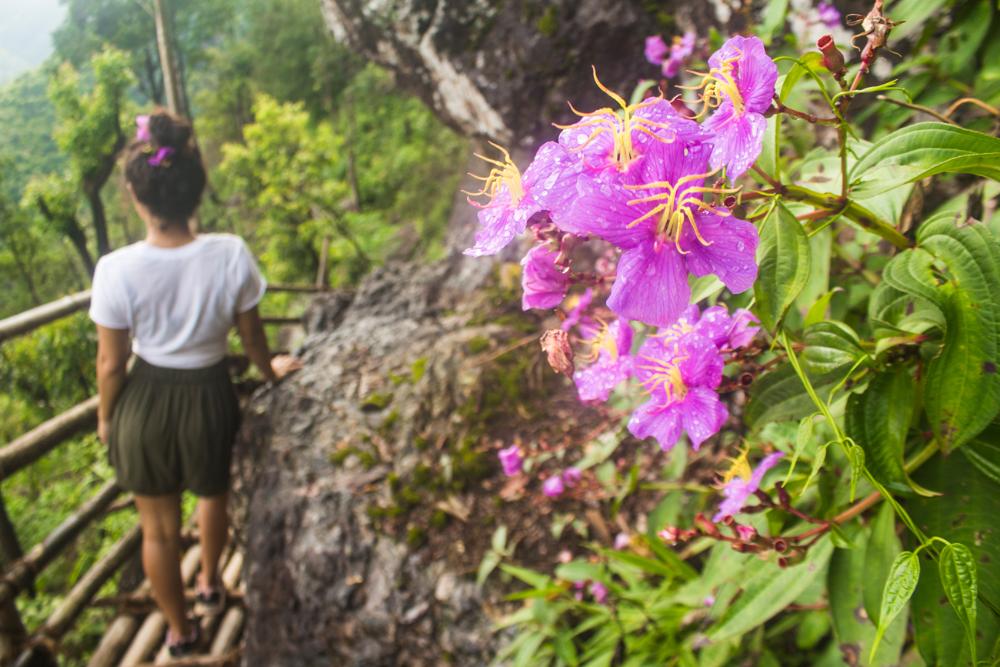
The blooms of spider plant (Cleome hassleriana), Chinese hibiscus (Hibiscus rosa-sinsenis), scarlet sage (Salvia splendens) and other plants embellish the roadsides and the villager’s gardens.
The arrowhead-shaped leaves of the taro plant (Colocasia esculenta) grow to impressive proportions here.
.jpg)
The village is largely dependent on orange cultivation and broom-making, a local cottage industry.
The brooms are made from broom grass (Thysanolaena latifolia), which is harvested from the surrounding forests and then stacked in bundles to dry in the sun and are taken in whenever it rains.
The road ends abruptly in a cul-de-sac at the far end of the village and beyond this are only jungle trails to other neighbouring villages.
One of these is the famous “whistling village” of Kongthong (where the residents whistle a unique tune for each member of the village instead of addressing them by a spoken name), which is approximately 3 hours on foot from here according to one Wahkhen villager that I spoke to.
The focal point of Wahkhen village if you’re planning to undertake the Mawrynkhang trek is the bamboo hut/tea stall, which is situated just above the trailhead car park, right beside the main road that passes through the village.
This tea stall with its tin roof and walls made from woven strips of split bamboo is where you can grab a bite to eat before you begin the trek and also when you arrive back at the village afterwards.
During our visit the stall had a menu limited to jadoh (Khasi-style rice), boiled eggs, Maggie (instant noodles), chana (boiled chickpeas) and red tea... and that’s about it.
The food is very inexpensive though, with most items costing less than Rs. 15/- You can fill your belly with food and drink a glass of red tea for around Rs. 60/- .
This bamboo hut is also where we met Shutit, the son of the tea-stall owner who organized accommodation for us in the village with the help of his father. Shutit was the person who was preparing food and serving us most of the time at the stall.
If you are hoping to stay overnight in Wahkhen, make sure that you tell him your plans upon your arrival.
The hut is also useful as a place to keep some of your luggage during the trek, as it is neither necessary nor advantageous to carry a lot of stuff on the trek with you.
We left our backpacks with laptops, hard drive and other important gear in them here in the hut during our trek and nothing had been stolen when we returned 4 hours later!
You will probably be asked to register for the trek at the hut, which involves filling details like your date of arrival, nationality, no. of persons, etc. into a large book.
You may be asked to pay the official entrance fee (see below) for the trek after registering, although they did not collect it from us for some reason (perhaps they forgot).
The entrance fees for the Mawrynkhang trek are as follows, although the villagers manning the bamboo hut do not appear to be strictly enforcing them:
Adult – Rs. 50/- per head
Minor – Rs. 20/- per head
Students in group with uniform – Half rate
Videography – Rs. 2000/-
- Waterproof poncho/ rain jacket & rain pants/ umbrella (it rains here a lot)
- Drinking water (1.5 – 2 litres should be sufficient)
- Snacks (sandwiches, potato chips, biscuits, peanuts, chocolate, bananas etc.)
- Digital camera (a waterproof one would be ideal)
- Headlamp (in case you don’t make it back before nightfall)
- A pair of trekking shoes with good grip (parts of the trail might be slippery)
- A GoPro or other action camera with a head strap would also be nice to bring along on the trek, as many parts of the trek are difficult to film or photograph with an ordinary camera, since your hands are frequently occupied while holding onto the side rails of the bridges and ladders.
You probably don’t need to hire a guide for the Mawrynkhang trek, especially not after you’ve read through this comprehensive virtual guide.
There isn’t really any way that you could get lost during the trek, as there is only one trail to follow, with no bifurcations or choices to make along the route.
However, if you are very unfit, have a fear of heights or are not very sure-footed, it might be a good idea to employ a guide for the physical assistance and moral support that he can provide.
There are a number of local guides in Wahkhen that often turn up at the bamboo hut and Shutit may also be available to guide you if you arrive in the village without one. The official village guides wear badges, so you will be able to recognize them if you see them.
If you don’t want to wing it, you can also try to arrange a guide beforehand in Shillong by consulting with some of the taxi drivers around the Police Bazaar area.
Many people book an all-inclusive tour with the northeast India tour operator Discover Northeast, which charges Rs. 3,700 for a 2-day tour starting in Guwahati, with the trek taking place on Day 2.
The price includes transport from Guwahati, guide fees, entrance fees (excluding camera charges), 1 breakfast, 2 lunches, 1 dinner and overnight tent camping (with a campfire jam session) in Wahkhen village the night before.
We have personally dealt with Discover Northeast at the Nagaland Hornbill Festival in December 2017 and we can assure you that they are all really nice and competent guys.
An all-inclusive tour definitely isn’t the cheapest way to do this trek, but is a necessary evil if you’d rather that someone else handle all the logistics.
Quick stats:
Trek completion time: 3-5 hours
Total distance: 3.54 km (1.77 km each way)
Difficulty level: Medium
Route summary:
Wahkhen -> Wahrew River (0.5 km)
Wahrew River -> Mawkhlieng Cliff (0.75 km)
Mawkhlieng Cliff -> Mawmoit Viewpoint (0.32 km)
Mawmoit Viewpoint -> Mawrynkhang Rock (0.2 km)
The average person with a reasonable level of fitness will complete this trek in about 3-4 hours with no faffing around, but if you’re taking loads of breaks and photos and what not, it could take you longer. The native Khasi people can supposedly do it in 40 minutes.
You will probably complete the return journey in less time than the outward journey, since on the way back you will most likely make fewer stops for photos and admiring views.
Another reason the return journey will be quicker is that you will have more faith in the bridges and ladders by this point and will be proceeding across them with less caution than before.
In our case we took about 2 hours to complete the outward journey to the rock and about 1 hour and 40 mins to complete the return journey, including a 20-minute dip in the Wahrew river.
I would recommend that you commence the trek no later than 1 p.m in the afternoon, as a later start than that might require you to rush in order to make it back before dark, and that would compromise your enjoyment of the trail.
Also, it's not safe to risk trekking on rickety bamboo bridges in the dark and once dusk approaches your odds of getting stranded in Wahkhen village will be greatly increased, so try to get back to the village while there's still daylight!
We’ve broken down the trek into three different parts so that you can better conceptualize it.
Part 1: Descent to the valley floor and crossing the Wahrew river
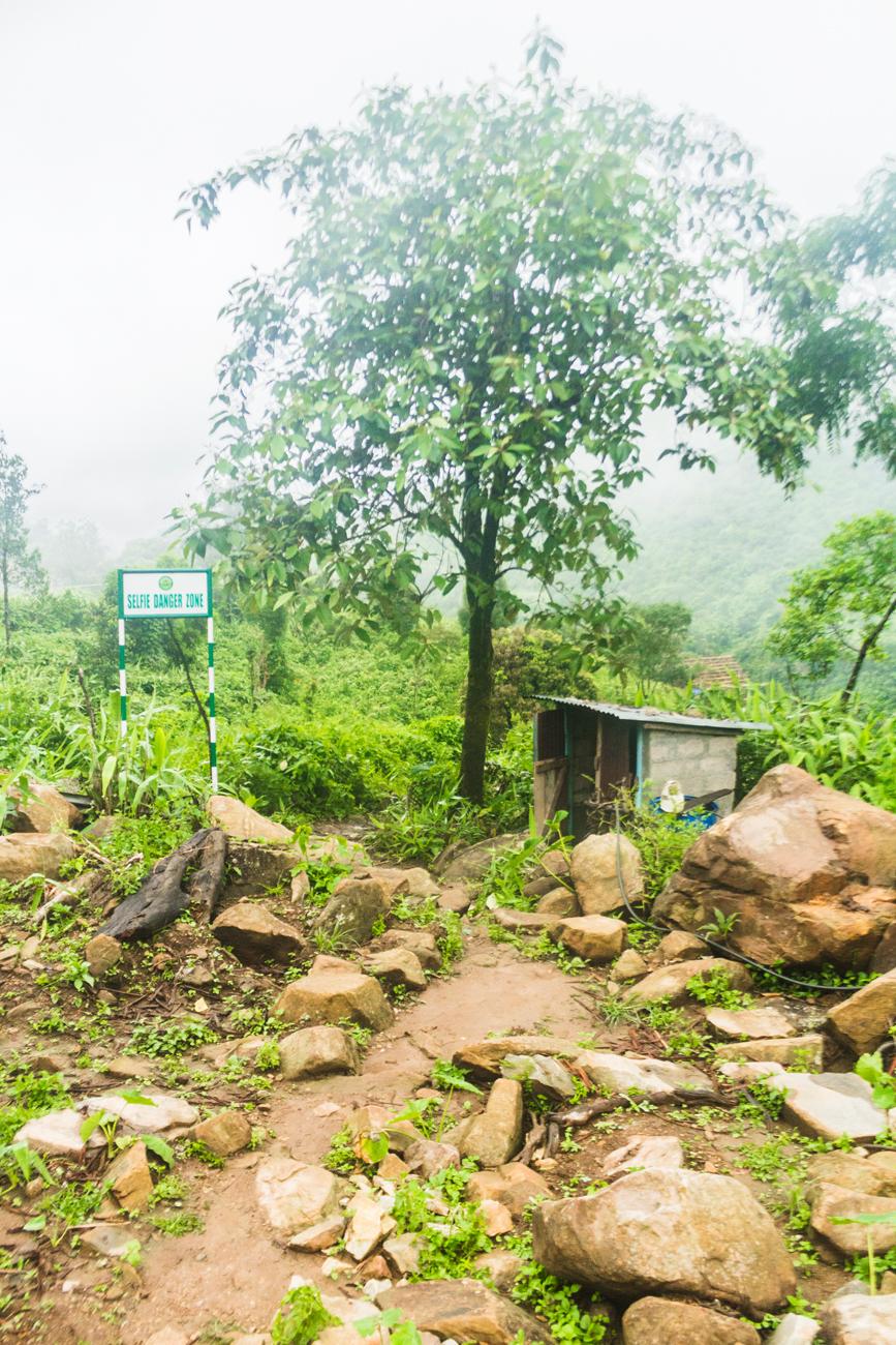
The Mawrynkheng trek begins from just below the parking area adjacent to the bamboo hut tea stall in Wahkhen village.
The beginning of the trek is marked by a green sign on the left that reads “Selfie Danger Zone” and a small outhouse (public toilet) on the right.
You will cross the entrance to a disused, elevated bamboo walkway on your right hand side just after you begin the trek.
Judging by photos on other blogs that we’ve read, trekkers used this walkway in the past, but during our trek the entrance to the walkway was barricaded.
We soon found out why when we observed that the walkway had completely collapsed and terminated just a few hundred metres ahead. Had we chosen to take the walkway, our trek would have ended almost as soon as it begun!
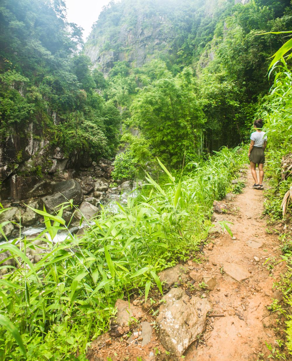
So make sure that you avoid the disused bamboo walkway and just stick to the natural trail, which descends at a moderate gradient towards the Wahrew River at the bottom of the valley.
On its the way down to the river the trail cuts through a dense, lush swath of broom grass. Man-made steps have been constructed from local stones at the steeper sections of the trail for ease of travel.
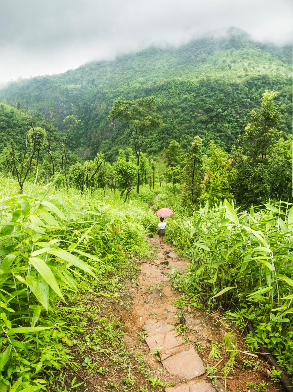
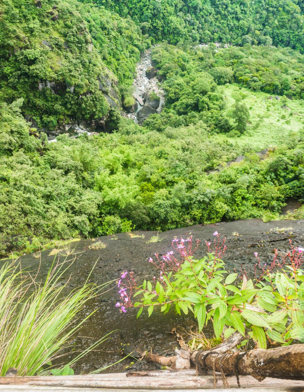
After a short distance, you will come to a marvellous vantage point overlooking the river valley below. Steps descend from both sides of this viewpoint; it doesn’t really matter which steps you choose, as the two paths merge together a little further ahead.
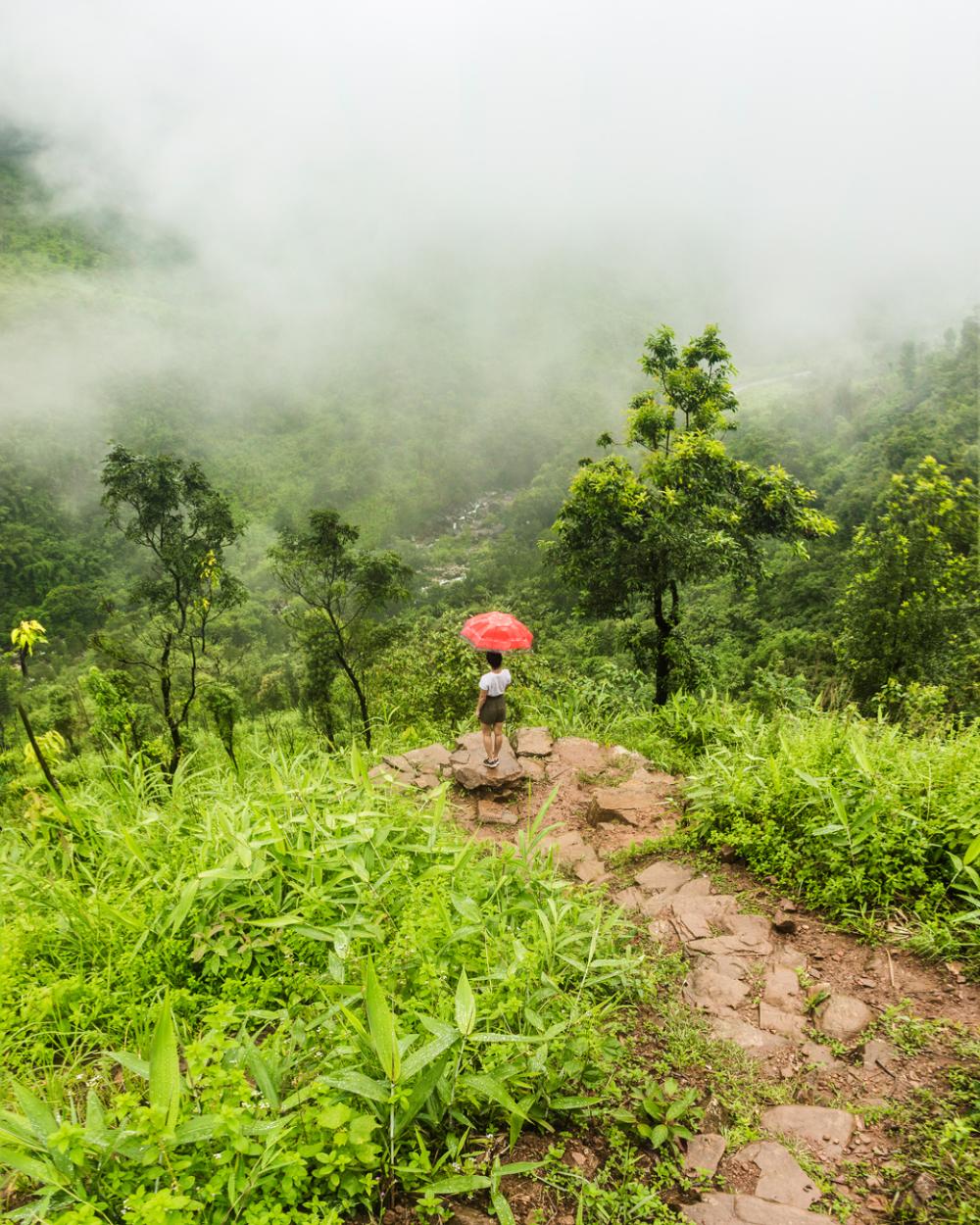
As you approach the bottom of the valley you will descend a final steep section and then you will arrive on the banks of the Wahrew River, one of Meghalaya’s most unadulterated rivers.
This is a great spot to take a refreshing dip in the river, although you might prefer to do that on your way back instead (watch out for the tiny fish that nibble at your fingers and toes!).
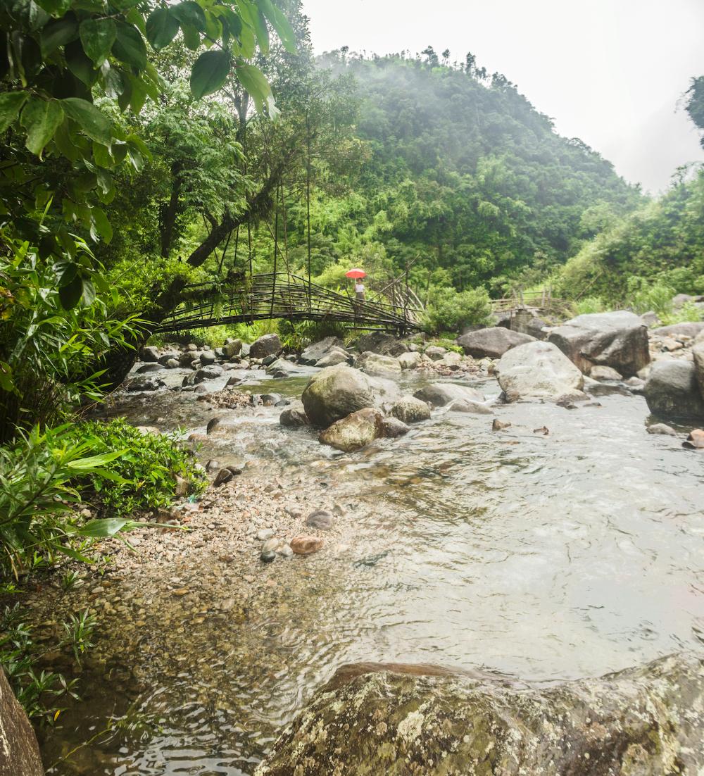
To continue on from this point, you’ll want to hang a left and follow the path alongside the river until you arrive at the beginning of a series of bamboo bridges that have been built to take you across the river.
This river crossing is the first point in the trek where you will have to place your faith in the wooden bridges that the villagers have constructed.
Yes, they look incredibly unreliable and they wobble like crazy when you place your weight on them (this is undoubtedly exacerbated by trembling legs), but you have to just hold your nerve and try to trust them, because there’s a hell of a lot more of them to come further ahead.
The last bridge that spans the widest stretch of the river is a twin span and a more permanent concrete bridge already appears to be under construction here.
Part 2: Wahrew river to Mawmoit Viewpoint
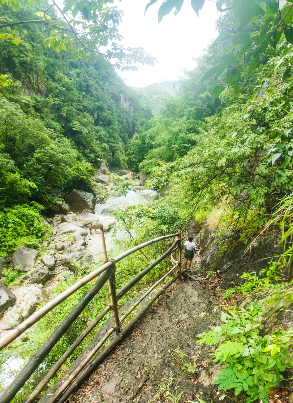
Once you’re over the first hurdle of the trek that is the Wahrew River, you will want to follow the path as it swings to the left and brings you down onto a rocky plateau next to a bend in the river.
During our trek a blue tarpaulin had been erected in this area to create a temporary encampment. This spot seems to be quite popular with locals for fishing from the rocks.
After the river rounds the bend here it enters a steep-sided gorge, and this is where the real fun begins.
As you leave the banks of the Wahrew river behind, you step onto a narrow trail, which gradually ascends from here on while hugging the wall of the gorge and paralleling the river below.
As you leave the banks of the Wahrew river behind, you step onto a narrow trail, which gradually ascends from here on while hugging the wall of the gorge and paralleling the river below.
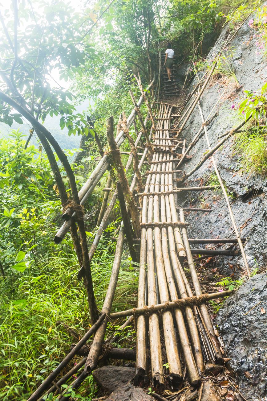
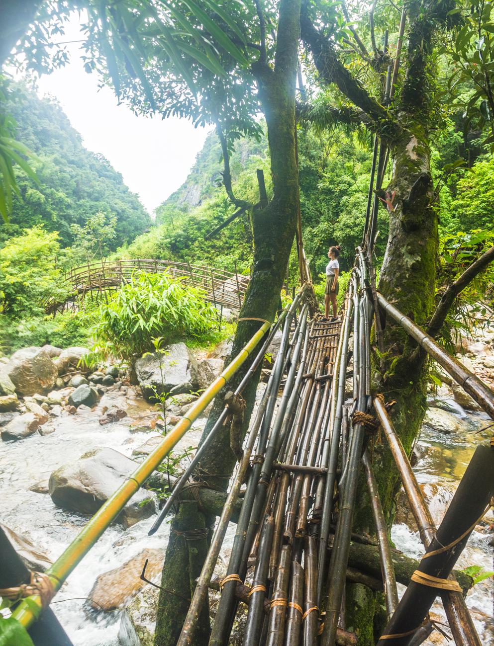
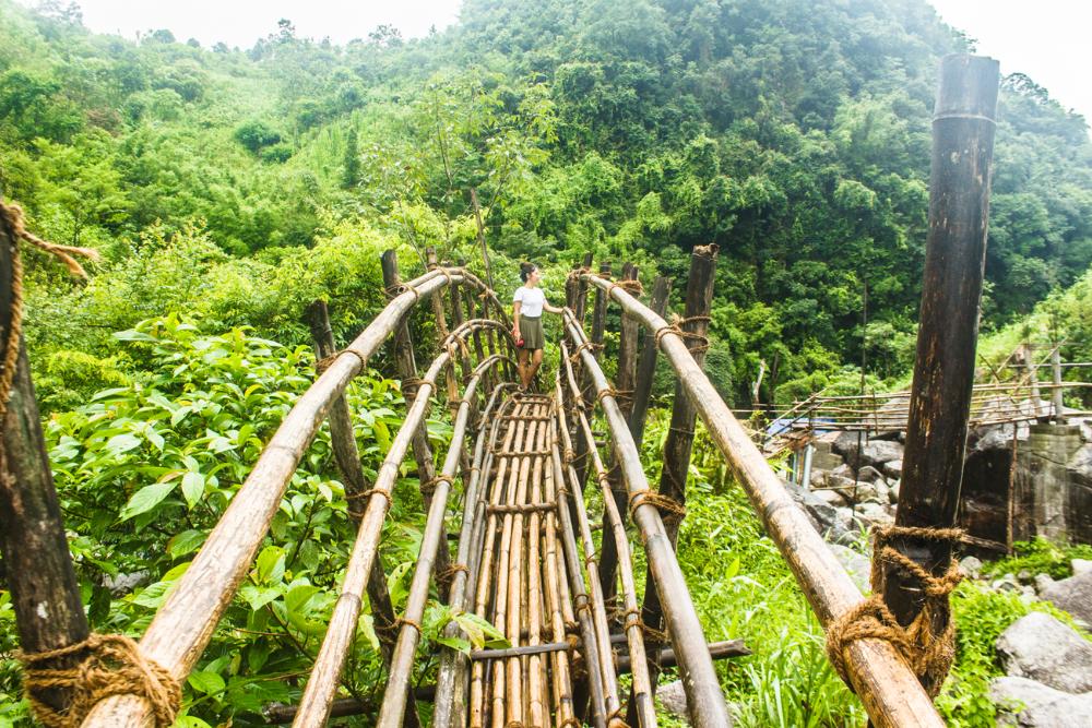
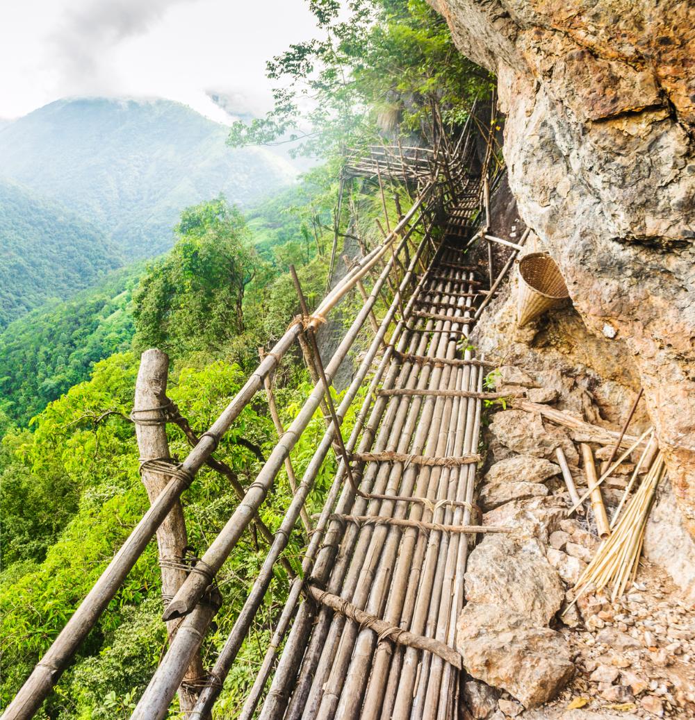
From this point on you’ll begin to encounter the man-made wooden bridges and inclined ladders (most are no steeper than 70 degrees) that are required to pass the precipitous sections of the trail, where a natural path is non-existent or too dangerous to use.
The bridges and ladders are constructed using lengths of bamboo and/or branches from other locally available trees.
The bridges have bamboo side rails for safety and also to provide something to grab onto for extra stability and support when crossing.
Some of the rungs of the bridges and ladders have been lashed in place with cane strips or jute rope. Others are only held in place with nails, while some cross members are secured in position with both.
.jpg)
You will pass through various bamboo stands during the trek where you can see the cut stumps of former bamboo trees, presumably harvested for the construction of the trail.
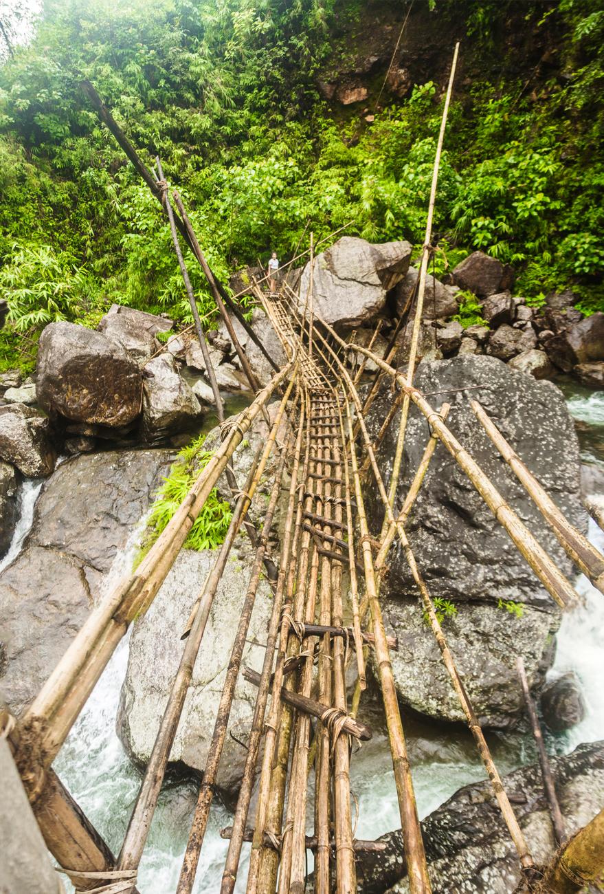
After some time hiking this ascending trail you will suddenly find that you have gained significant elevation and the river now seems a long way below at the bottom of the gorge.
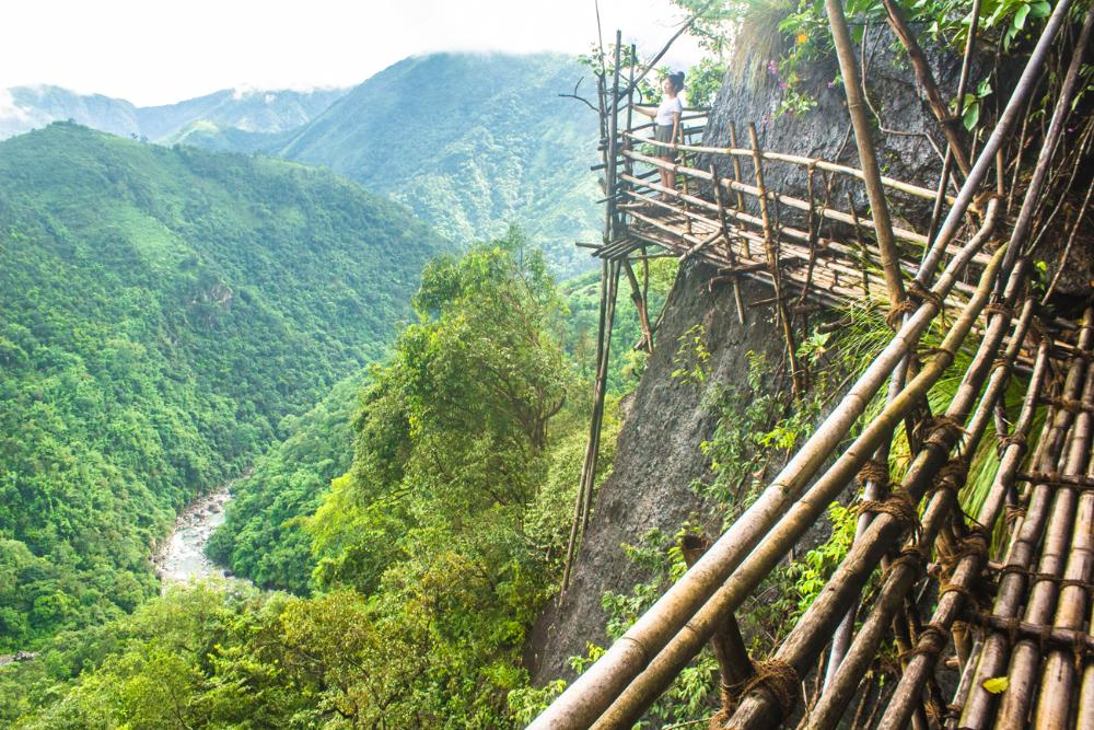
It is not long after this realization that you will arrive at the Mawkhlieng Cliff - the scariest and most exposed section of the trail. For some of you, this may be the climax of the entire trek.
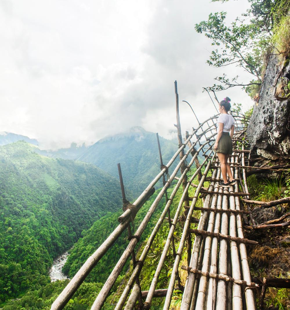
Here a continuous bamboo walkway allows you to traverse a near-vertical cliff face while a dizzying drop looms on your left hand side. One wrong move here and you’re finished. I would advise you not to peer over the side rails here, as your legs just might turn to jelly.
One thing that slightly baffled me about this exposed stretch was how this walkway was being held up.
Some sections of the bamboo walkway were resting on iron rods that were embedded in the bare rock of the cliff face, or on branches that were wedged into crevices in the rock, but others sections seemed to defy gravity, and I felt like they might collapse at any moment.
In any case, you really just have to take a huge leap of faith here and just believewithout reason to, like when Indiana Jones steps out onto thin air above the abyss in the 1989 film, Indiana Jones And The Last Crusade.
You will probably breathe a sigh of relief when you have finally made it the end of this exposed stretch along the cliff face.
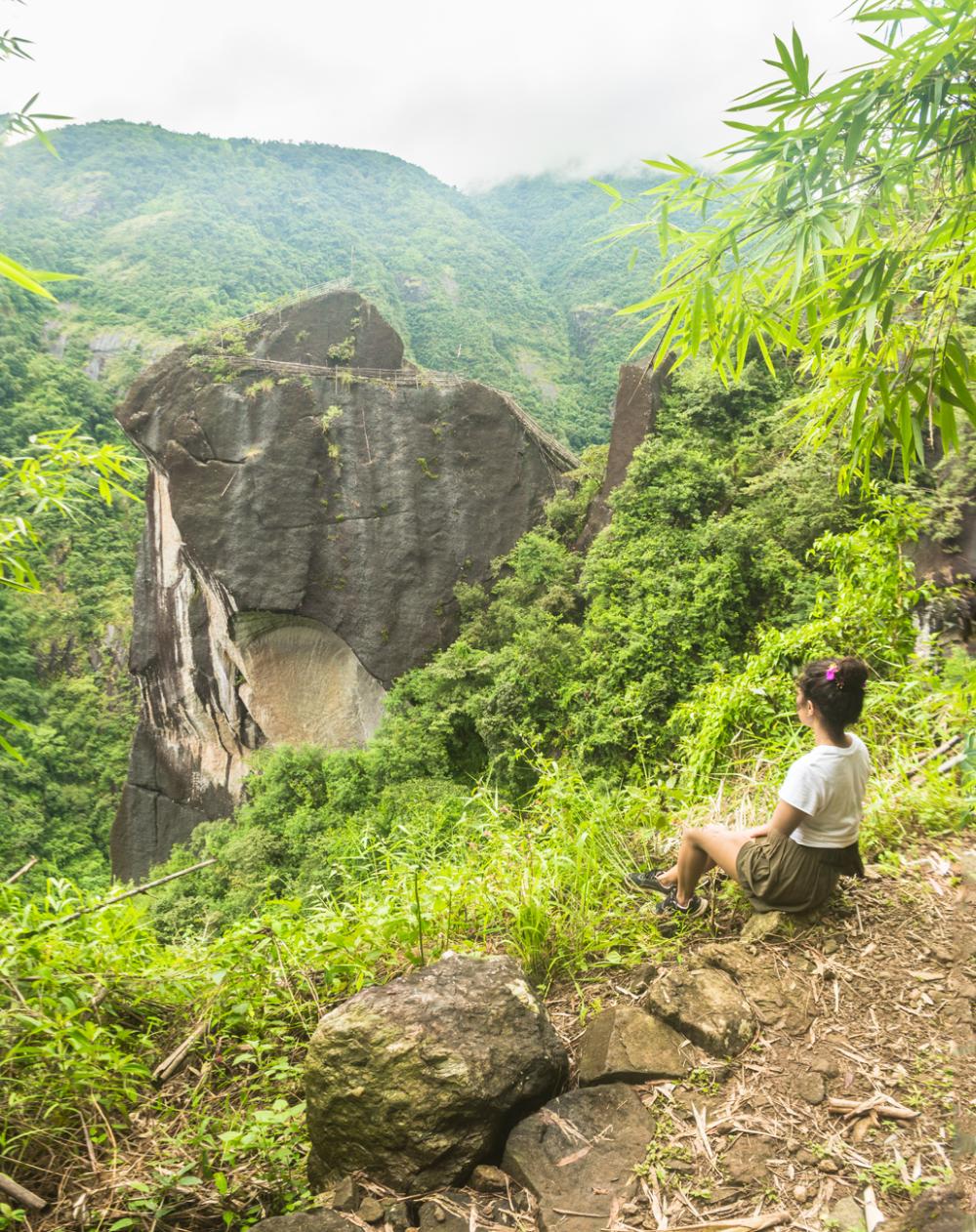
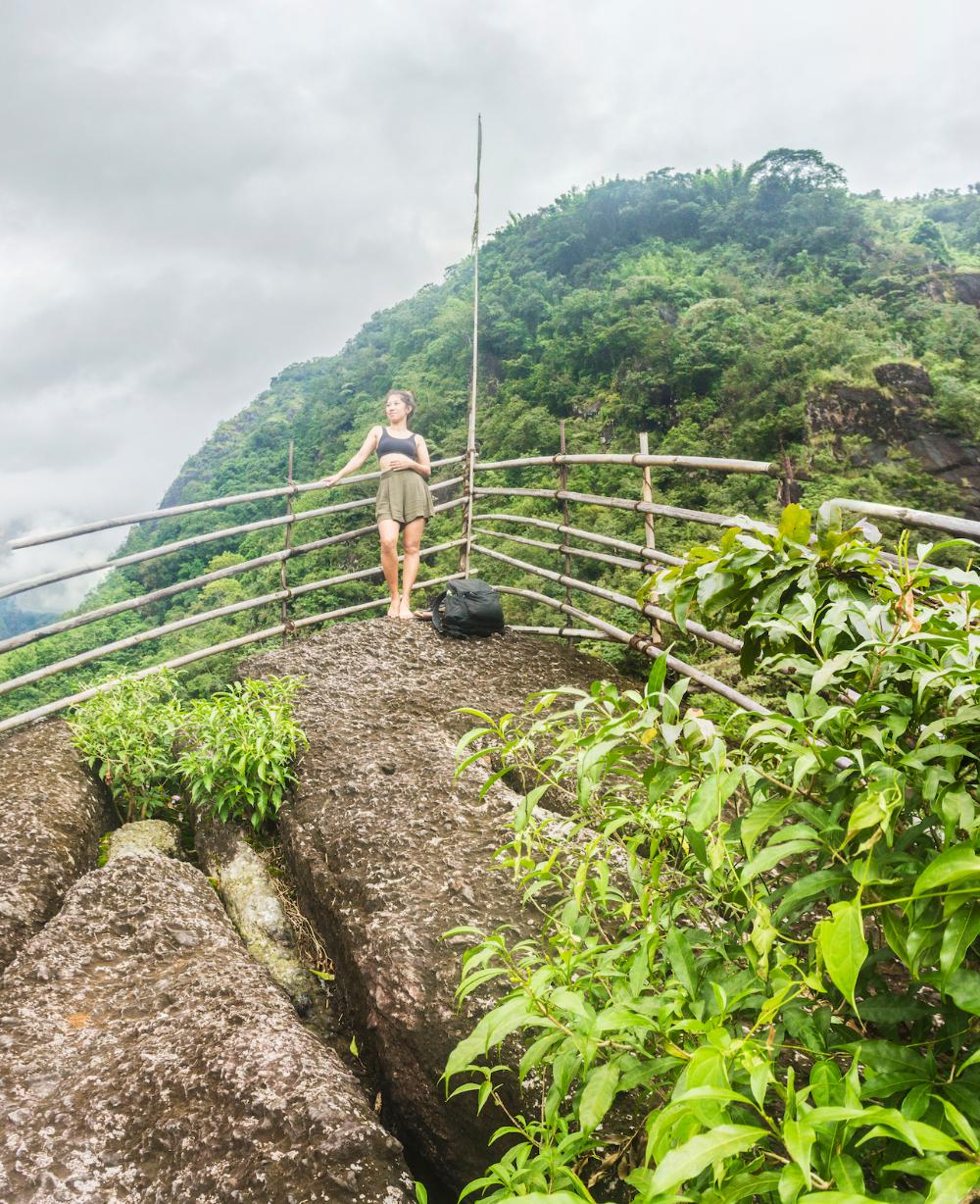
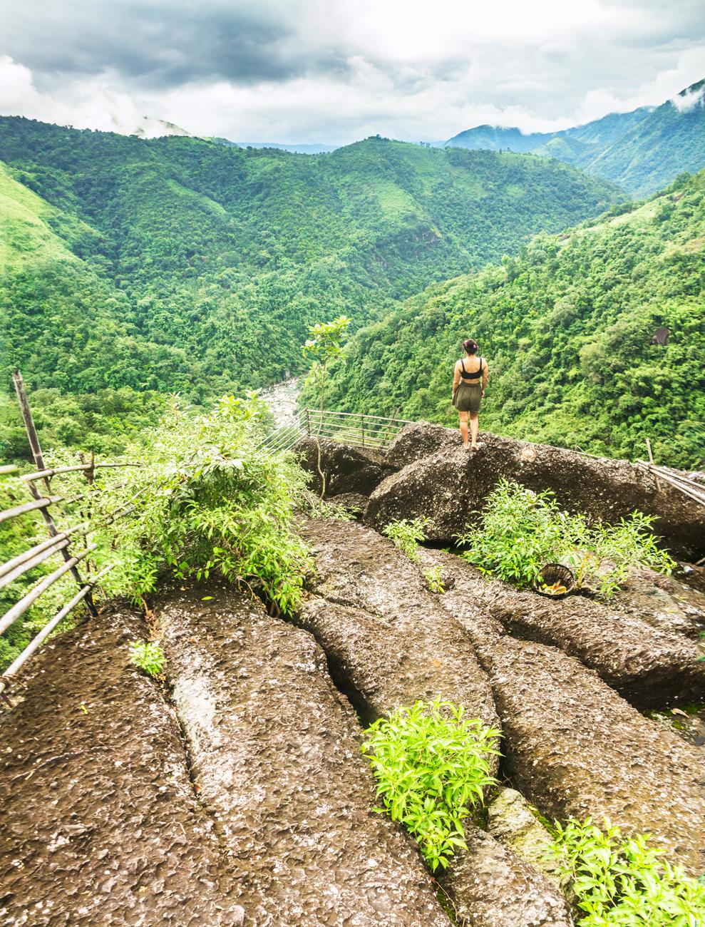
From here the trail continues to ascend for another little bit and finally brings you to the Mawmoit Viewpoint, a rock outcrop that commands sensational views of the surrounding hills and river valleys.
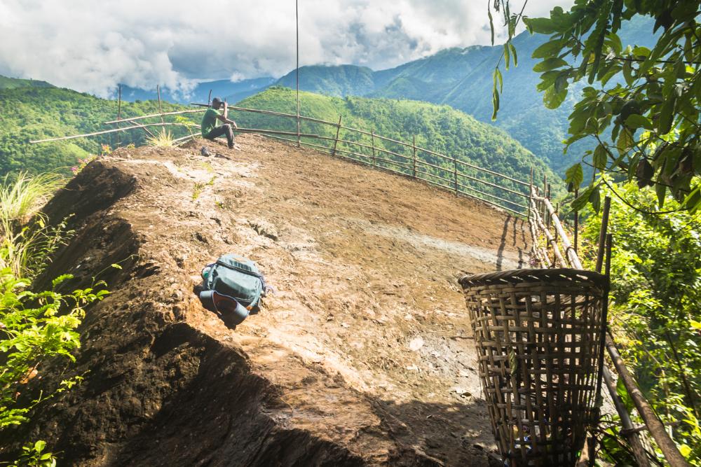
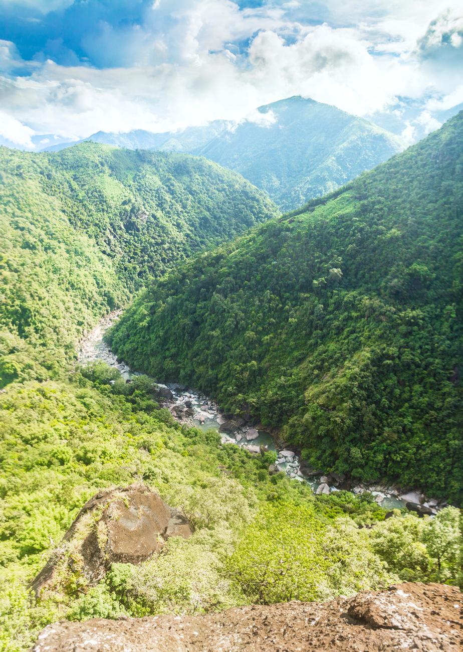
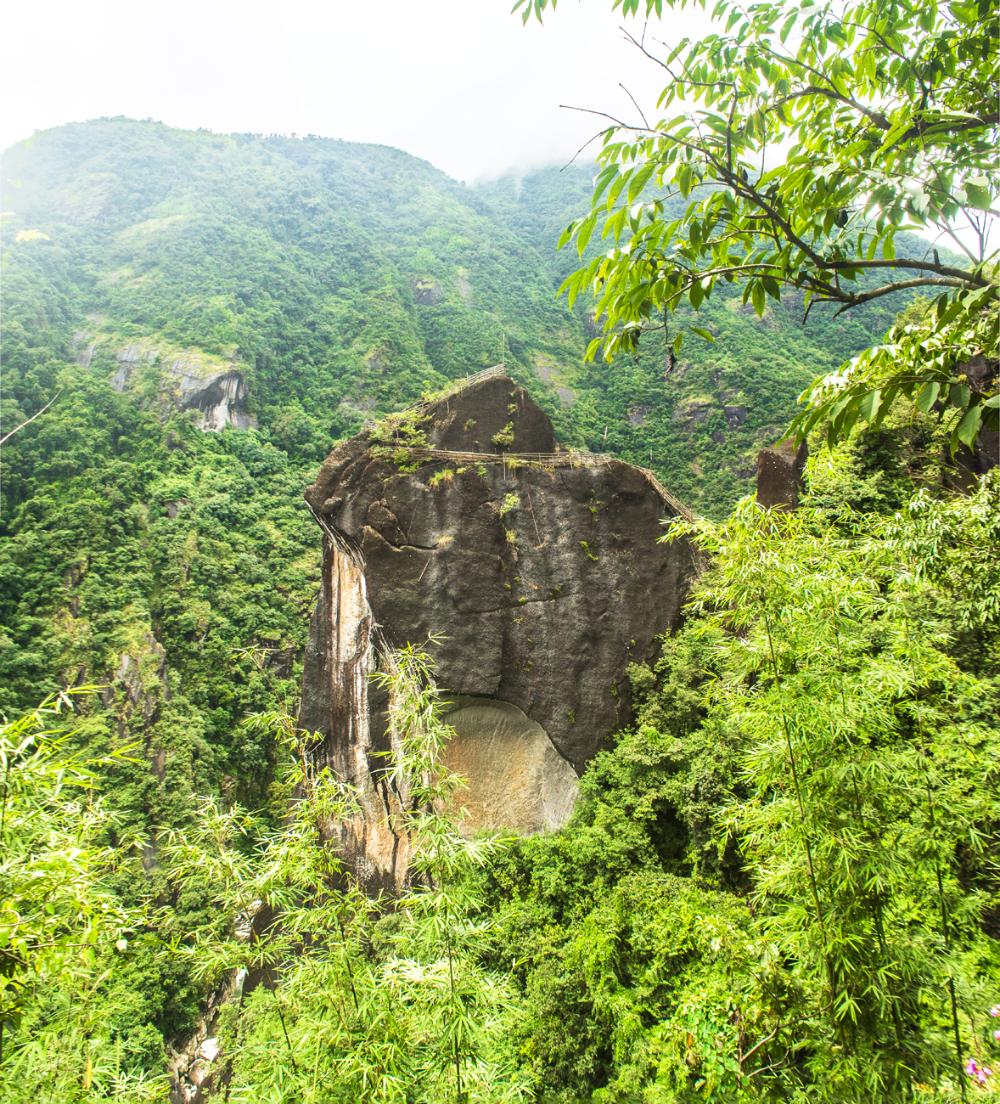
While standing upon this great slab of bare rock you will also be able to witness the king of rocks for the very first time during the trek, although he is still a little far off .
.jpg)
Part 3: Mawmoit Viewpoint to Mawrynkhang
The final stage of the trek is mostly descending, taking you from the Mawmoit viewpoint all the way to the pinnacle of U Mawrynkhang.
There’s a tight squeeze through a rocky gap just beyond the Mawmoit viewpoint and after descending further you will arrive at a nice vantage point of U Mawrynkhang.
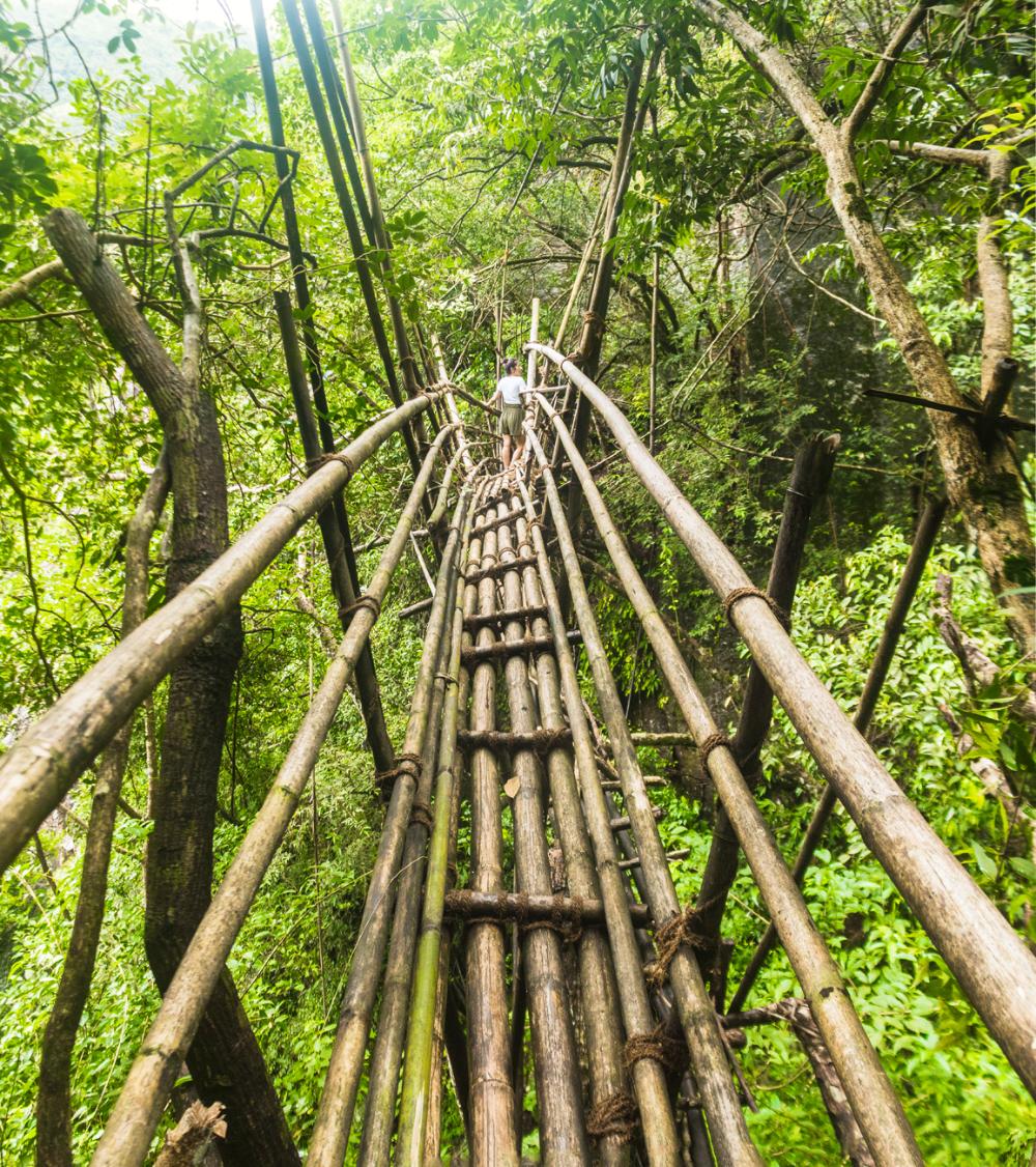
Further progress along the tail brings you to a long, arched bamboo bridge that has been constructed to allow trekkers to safely cross a dangerous ravine.
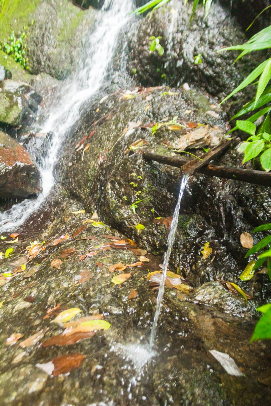
Just near the bridge there’s a little waterfall (it may dry up at certain times of year), which serves as a perfect spot to refill your water bottle and freshen up.
To get to the waterfall you need to step off the main trail before stepping onto the bridge and walk across the slab of exposed bedrock to reach it. I drank the water directly from this cascade with no ill effects.
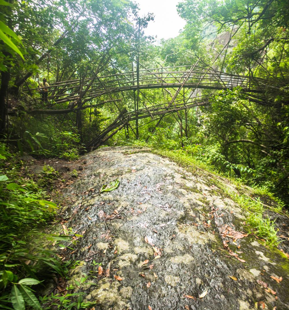
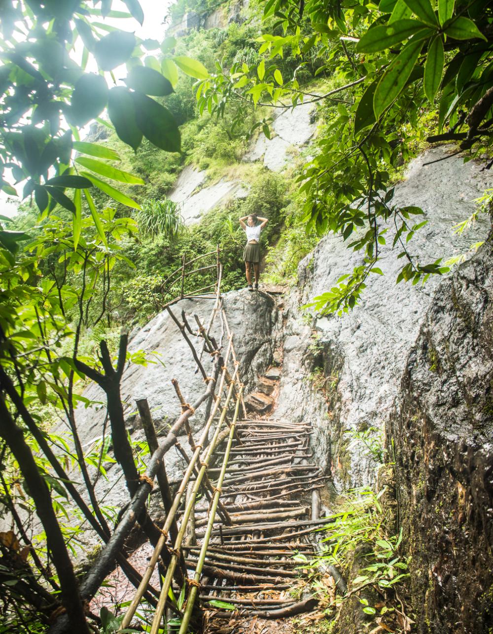
After crossing over the ravine, the trail undulates a little bit until you come to the final hurdle of the trek; the transition from the valley slope onto the rock of Mawrynkheng itself.
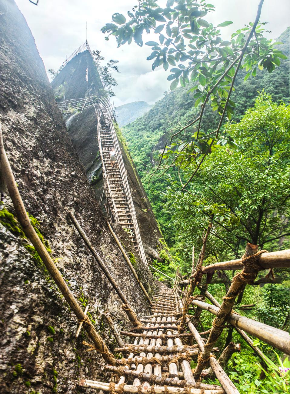
As you can see from the photo above, a walkway descends steeply towards the rock and this links up with a long, steep ladder that brings you up onto a ledge that sits just below the pinnacle of the rock.
Once you’ve made it up onto this ledge, you just have to follow the trail along the ledge, climb up two more (small) ladders, clamber up the sloping top surface of the rock and then you’re there! You’ve reached the pinnacle of the king of rocks.
Make sure that you savour this moment and appreciate nature's splendour all around you. Now all that's left to be done is to trek back to Wahkhen.
The way back is pretty easy going for the most part, but the final climb from the river up to the village will have your quadricep muscles screaming for mercy.
Hopefully you will leave Wahkhen village with beautiful memories of this trek that you will cherish forever.
If you enjoyed this article, please share it with other travellers. If you have any questions about the Mawrynkhang trek please don’t hesitate to leave us a comment and we will get back to you as soon as possible.
JOIN OUR LIST
SUPPORT US
FOLLOW US
ABOUT US
Our names are Eoghan and Jili and we hail from Ireland and India respectively.
We are two ardent shoestring budget adventure travellers and have been travelling throughout Asia continuously for the past few years.
Having accrued such a wealth of stories and knowledge from our extraordinary and transformative journey, our mission is now to share everything we've experienced and all of the lessons we've learned with our readers.
Do make sure to subscribe above in order to receive our free e-mail updates and exclusive travel tips & hints. If you would like to learn more about our story, philosophy and mission, please visit our about page.
Never stop travelling!
FOLLOW US ON FACEBOOK
FOLLOW US ON PINTEREST
